
IMAGES TAKEN NEAR TO
Roundwood Road, LONDON, NW10 3UG
Introduction
This page details the photographs taken nearby to Roundwood Road, NW10 3UG by members of the Geograph project.
The Geograph project started in 2005 with the aim of publishing, organising and preserving representative images for every square kilometre of Great Britain, Ireland and the Isle of Man.

There are currently over 7.5m images from over14,400 individuals and you can help contribute to the project by visiting https://www.geograph.org.uk
Image Map
Images are licensed for reuse under creativecommons.org/licenses/by-sa/2.0
Notes
- Clicking on the map will re-center to the selected point.
- The higher the marker number, the further away the image location is from the centre of the postcode.
Image Listing (86 Images Found)
Images are licensed for reuse under creativecommons.org/licenses/by-sa/2.0
Image
Details
Distance
1
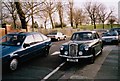
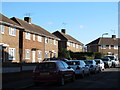
Wolseley 15/50 on Longstone Avenue, Willesden 1998
My Proton can be seen opposite. Roundwood Park is in the background.
Image: © David Howard
Taken: Unknown
0.02 miles
2
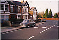
Wolseley 15/50 on Longstone Avenue, Willesden 1998
Image: © David Howard
Taken: Unknown
0.03 miles
3
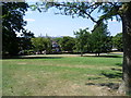
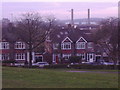
View from the top of Roundwood Park
In the 19th century, this site was adjacent to the grounds of Roundwood House. The land for the park was purchased from Messrs. Perkins and Weston for £15,000, with the help of private donations.
The park was opened to the public in May 1895. Five miles of drainage and two miles of paths had to be laid, and 14,500 trees were planted. A lodge was built to house the gardener. At the time of the park's opening it was described as a "veritable Garden of Eden, without the serpent", and much was made in the opening speeches of the fact that the park was now permanently protected from development and would remain so, even when all the beautiful green fields that people could see around them had been developed.
This view is from the slope of the hill which forms the highest part of the park. The chimneys on the left belong to Taylor's Lane Power Station, while to the right is the unmistakable shape of the Wembley Arch.
Image: © Marathon
Taken: 30 Jul 2014
0.09 miles
4
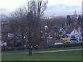
Longstone Avenue from Roundwood Park
The new (new to me anyway) Wembley stadium can just be seen on the left.
Image: © David Howard
Taken: 2 Dec 2008
0.10 miles
7
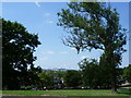
View from the top of Roundwood Park
In the 19th century, this site was adjacent to the grounds of Roundwood House. The land for the park was purchased from Messrs. Perkins and Weston for £15,000, with the help of private donations.
The park was opened to the public in May 1895. Five miles of drainage and two miles of paths had to be laid, and 14,500 trees were planted. A lodge was built to house the gardener. At the time of the park's opening it was described as a "veritable Garden of Eden, without the serpent", and much was made in the opening speeches of the fact that the park was now permanently protected from development and would remain so, even when all the beautiful green fields that people could see around them had been developed.
This view is from the top of the hill which forms the highest part of the park. In the centre is the unmistakable shape of the Wembley Arch.
Image: © Marathon
Taken: 30 Jul 2014
0.12 miles
10
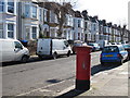
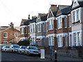
Roundwood Road, NW10 (2)
Shows the location of Image
Image: © Mike Quinn
Taken: 15 Feb 2012
0.14 miles