IMAGES TAKEN NEAR TO
Tiverton Road, LONDON, NW10 3HL
Introduction
This page details the photographs taken nearby to Tiverton Road, NW10 3HL by members of the Geograph project.
The Geograph project started in 2005 with the aim of publishing, organising and preserving representative images for every square kilometre of Great Britain, Ireland and the Isle of Man.

There are currently over 7.5m images from over14,400 individuals and you can help contribute to the project by visiting https://www.geograph.org.uk
Image Map
Images are licensed for reuse under creativecommons.org/licenses/by-sa/2.0
Notes
- Clicking on the map will re-center to the selected point.
- The higher the marker number, the further away the image location is from the centre of the postcode.
Image Listing (72 Images Found)
Images are licensed for reuse under creativecommons.org/licenses/by-sa/2.0
Image
Details
Distance
3
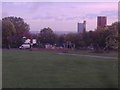
View from playing fields towards Central London
Trellick Tower is the first of the blocks on the right. You can also see the GPO Tower if looking to the left beyond this view but my zoom could not do justice to it.
Image: © David Howard
Taken: 9 Oct 2013
0.08 miles
4
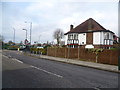
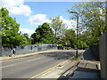
Tiverton Road
This view is from near the railway bridge carrying Tiverton Road over the London Overground. The lorry is standing in The Avenue and the open space known as Tiverton Green is beyond.
Image: © Marathon
Taken: 22 Jan 2014
0.09 miles
5
Mount Pleasant Road from Okehampton Road
Image: © David Howard
Taken: 9 Oct 2013
0.11 miles
6
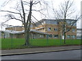
Queens Park Community School
Opened in 1989, Queens Park Community School is the result of an amalgamation of three schools during the 1980s. The three schools that were merged were South Kilburn High School (formally Percy Road School), Aylestone Community School and Brondesbury and Kilburn High, (formerly Kilburn Grammar School).
This is the view from Aylestone Avenue.
Image: © Marathon
Taken: 22 Jan 2014
0.12 miles
7
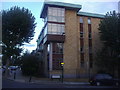
Flats on the corner of Crediton Road, Kensal Rise
Image: © David Howard
Taken: 9 Oct 2013
0.13 miles