IMAGES TAKEN NEAR TO
Tiverton Road, LONDON, NW10 3HH
Introduction
This page details the photographs taken nearby to Tiverton Road, NW10 3HH by members of the Geograph project.
The Geograph project started in 2005 with the aim of publishing, organising and preserving representative images for every square kilometre of Great Britain, Ireland and the Isle of Man.

There are currently over 7.5m images from over14,400 individuals and you can help contribute to the project by visiting https://www.geograph.org.uk
Image Map
Images are licensed for reuse under creativecommons.org/licenses/by-sa/2.0
Notes
- Clicking on the map will re-center to the selected point.
- The higher the marker number, the further away the image location is from the centre of the postcode.
Image Listing (88 Images Found)
Images are licensed for reuse under creativecommons.org/licenses/by-sa/2.0
Image
Details
Distance
3
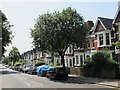
North west entrance to Queen's Park
On the junction of Milman Road and Chevening Road.
Image: © Rod Allday
Taken: 21 May 2019
0.04 miles
5
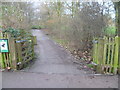
Entrance to the Woodland Walk, Queen's Park
The area that is now Queen's Park was part of the site of the 1879 Royal Kilburn Agricultural Show which had been attended by Queen Victoria. In 1885, the land on which Queen’s Park is now located was offered, along with Highgate Wood, to the Corporation of the City of London as a gift by the Ecclesiastical Commissioners “for preservation as open spaces for ever”. The Corporation was happy to accept Highgate Wood, but not so keen on Queen’s Park because of the anticipated maintenance costs. The Commissioners, however, insisted it was both or nothing. At that time the Corporation’s income for the preservation of open spaces was limited, but fortunately the generous bequest of a William Ward came to the rescue. He provided a sum of money “for the creation of some fund for the benefit of the poorer classes”. Some £3,000 of this was used by the Corporation to lay out Queen’s Park. It was originally called Kilburn Recreation Ground, but an application was made to Queen Victoria to change the name to Queen's Park in honour of her Golden Jubilee of that year. The park was formally opened on 5th November 1887 by the Lord Mayor of London. On the opening day “the great majority of the vast crowd was composed evidently of the respectable classes”. A very detailed and interesting history of Queen's Park can be seen at https://www.cityoflondon.gov.uk/things-to-do/green-spaces/queens-park/Pages/default.aspx
This is the Woodland Walk in Queen's Park which is next to Chevening Road. The Woodland Walk was created in 1999 when the figure-of-eight footpaths were reinstated.
Image: © Marathon
Taken: 22 Jan 2014
0.06 miles
6
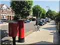
Chevening Road, NW6 (2)
Shows the location of Image
Image: © Mike Quinn
Taken: 4 Jul 2011
0.06 miles
7
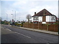
Tiverton Road
This view is from near the railway bridge carrying Tiverton Road over the London Overground. The lorry is standing in The Avenue and the open space known as Tiverton Green is beyond.
Image: © Marathon
Taken: 22 Jan 2014
0.08 miles
8
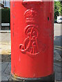
Edward VII postbox, Chevening Road / Peploe Road, NW6 - royal cipher
See Image
Image: © Mike Quinn
Taken: 4 Jul 2011
0.09 miles
9
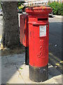
Edward VII postbox, Chevening Road / Peploe Road, NW6
Image: © Mike Quinn
Taken: 4 Jul 2011
0.09 miles