
IMAGES TAKEN NEAR TO
Dudden Hill Lane, LONDON, NW10 1DE
Introduction
This page details the photographs taken nearby to Dudden Hill Lane, NW10 1DE by members of the Geograph project.
The Geograph project started in 2005 with the aim of publishing, organising and preserving representative images for every square kilometre of Great Britain, Ireland and the Isle of Man.

There are currently over 7.5m images from over14,400 individuals and you can help contribute to the project by visiting https://www.geograph.org.uk
Image Map
Images are licensed for reuse under creativecommons.org/licenses/by-sa/2.0
Notes
- Clicking on the map will re-center to the selected point.
- The higher the marker number, the further away the image location is from the centre of the postcode.
Image Listing (162 Images Found)
Images are licensed for reuse under creativecommons.org/licenses/by-sa/2.0
Image
Details
Distance
1
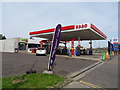
Service station on Dudden Hill Lane, London NW10
Image: © JThomas
Taken: 3 Aug 2019
0.01 miles
2
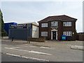
Hillside House, Dudden Hill Lane, London NW10
Image: © JThomas
Taken: 3 Aug 2019
0.02 miles
3
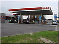
Esso Petrol Station
This petrol station is on the A4088 Dudden Hill Lane
Image: © Oxyman
Taken: 11 Jun 2007
0.03 miles
5
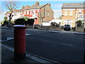
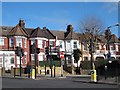
Burnley Road, NW10 (2)
Shows the location of Image
Image: © Mike Quinn
Taken: 15 Feb 2012
0.05 miles
6
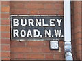
Sign for Burnley Road, NW10
Image: © Mike Quinn
Taken: 15 Feb 2012
0.06 miles
7
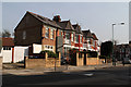
Houses Beside Aberdeen Road
A short terrace located on the junction of Aberdeen Road and Burnley Road - Aberdeen Road curves away and some of the other houses on the road are visible on the right of the photo.
Image: © Martin Addison
Taken: 23 Mar 2012
0.06 miles
8
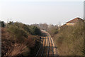
Railway Through Dudden Hill
A view of the Midland Railway's Acton Wells to Cricklewood line as it passes through a deep cutting. The view is taken from the bridge carrying Dudden Hill Lane over the railway and is looking in the Willesden Junction / Acton Wells direction. The twin chimneys of Taylors Lane Power Station are visible on the left and the railway passes to the left of them as it continues its curve.
Image: © Martin Addison
Taken: 23 Mar 2012
0.06 miles
10
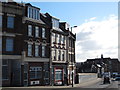
Dudden Hill Lane, NW10 (2)
South of Burnley Road.
Image: © Mike Quinn
Taken: 15 Feb 2012
0.07 miles