
IMAGES TAKEN NEAR TO
Lovett Way, LONDON, NW10 0UL
Introduction
This page details the photographs taken nearby to Lovett Way, NW10 0UL by members of the Geograph project.
The Geograph project started in 2005 with the aim of publishing, organising and preserving representative images for every square kilometre of Great Britain, Ireland and the Isle of Man.

There are currently over 7.5m images from over14,400 individuals and you can help contribute to the project by visiting https://www.geograph.org.uk
Image Map
Images are licensed for reuse under creativecommons.org/licenses/by-sa/2.0
Notes
- Clicking on the map will re-center to the selected point.
- The higher the marker number, the further away the image location is from the centre of the postcode.
Image Listing (69 Images Found)
Images are licensed for reuse under creativecommons.org/licenses/by-sa/2.0
Image
Details
Distance
1
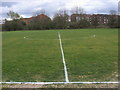
Halfway Line
Halfway Line on football pitch on Tokyngton recreation ground
Image: © Shaun Ferguson
Taken: 27 Mar 2009
0.10 miles
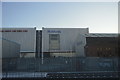

4
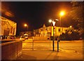
St Raphaels Way, Neasden
McDonald's is on the left
Image: © David Howard
Taken: 5 Aug 2014
0.12 miles
5
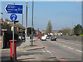
The North Circular Road, west of Woodheyes Road, NW10
Shows the location of Image
Image: © Mike Quinn
Taken: 20 Apr 2012
0.14 miles
6
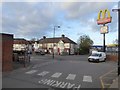
Entrance to McDonald's and the end of St Raphael's Way
Image: © David Smith
Taken: 23 Nov 2017
0.14 miles

9
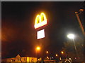
The golden arches, Neasden
Probably at their best at night. I was just going past and thought there's a photo waiting to be taken.
Image: © David Howard
Taken: 5 Aug 2014
0.14 miles
10
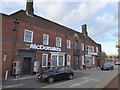
McDonald's drive-through fast food
Formerly the Pantiles Inn
Image: © David Smith
Taken: 23 Nov 2017
0.14 miles