IMAGES TAKEN NEAR TO
Attewood Avenue, LONDON, NW10 0HD

Introduction

This page details the photographs taken nearby to Attewood Avenue, NW10 0HD by members of the Geograph project.

The Geograph project started in 2005 with the aim of publishing, organising and preserving representative images for every square kilometre of Great Britain, Ireland and the Isle of Man.

There are currently over 7.5m images from over14,400 individuals and you can help contribute to the project by visiting https://www.geograph.org.uk

Image Map


Images are licensed for reuse under creativecommons.org/licenses/by-sa/2.0
Notes
  • Clicking on the map will re-center to the selected point.
  • The higher the marker number, the further away the image location is from the centre of the postcode.

Image Listing (67 Images Found)

Images are licensed for reuse under creativecommons.org/licenses/by-sa/2.0
  • ...
Image
Details
Distance
1
Aboyne Road, Neasden
Image: © Des Blenkinsopp Taken: 20 Jan 2020
0.04 miles
2
Aboyne Road, Neasden
Image: © David Howard Taken: 27 Feb 2014
0.05 miles
3
A406 south of The Welsh Harp
Image: © Stuart Logan Taken: 7 Aug 2014
0.06 miles
4
Entrance to Neasden Recreation Ground
From Aboyne Road
Image: © David Howard Taken: 27 Feb 2014
0.06 miles
5
North Circular Road in Neasden
Houses line the "red route clearway", with direct access onto it.
Image: © Peter Whatley Taken: 3 Apr 2012
0.07 miles
6
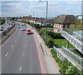
Houses on the west side of the North Circular Road, Neasden
Viewed from this http://www.geograph.org.uk/photo/3071639 footbridge. The red van has just passed the Aboyne Road turning.
Image: © Jaggery Taken: 13 May 2012
0.08 miles
7
Neasden Recreation Ground
This is on the south side of the Welsh Harp reservoir
Image: © David Howard Taken: 27 Feb 2014
0.08 miles
8
Kenwyn Drive footbridge, London NW2
Viewed across the North Circular Road (A406) from the edge of Neasden Recreation Ground. The far side of the footbridge is in Kenwyn Drive.
Image: © Jaggery Taken: 13 May 2012
0.10 miles
9
Aboyne Road, NW10
Image: © Mike Quinn Taken: 15 Feb 2012
0.10 miles
10
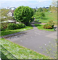
Neasden Recreation Ground, London
Viewed from this http://www.geograph.org.uk/photo/3071639 footbridge. The recreation area is alongside Brent Reservoir. http://www.geograph.org.uk/photo/3071543 Wembley Stadium http://www.geograph.org.uk/photo/665105 is in the top left corner.
Image: © Jaggery Taken: 13 May 2012
0.11 miles
  • ...