IMAGES TAKEN NEAR TO
Herbert Nursey Close, NORWICH, NR8 6BX
Introduction
This page details the photographs taken nearby to Herbert Nursey Close, NR8 6BX by members of the Geograph project.
The Geograph project started in 2005 with the aim of publishing, organising and preserving representative images for every square kilometre of Great Britain, Ireland and the Isle of Man.

There are currently over 7.5m images from over14,400 individuals and you can help contribute to the project by visiting https://www.geograph.org.uk
Image Map
Images are licensed for reuse under creativecommons.org/licenses/by-sa/2.0
Notes
- Clicking on the map will re-center to the selected point.
- The higher the marker number, the further away the image location is from the centre of the postcode.
Image Listing (10 Images Found)
Images are licensed for reuse under creativecommons.org/licenses/by-sa/2.0
Image
Details
Distance
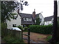
2
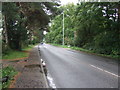
Drayton High Road
Looking south east on the A1067.
Image: © JThomas
Taken: 16 Sep 2017
0.06 miles
3
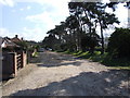
Private Road running parallel to A1074, Drayton
Image: © Ian Robertson
Taken: 7 Apr 2007
0.18 miles
4
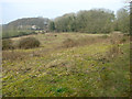
View across Bloods Dale
This area is part of the former David Rice mental hospital site. The hospital buildings stood further to the north, on the other side of the woodland seen in the background.
The name Bloods Dale is believed to derive from a battle between the Danes and the Saxons that was fought here. An early Saxon cremation cemetery was unearthed in the mid-19th century and thirteen skeletons of unknown date were found during the construction of the railway line, a little further to the west.
Image: © Evelyn Simak
Taken: 14 Mar 2014
0.22 miles
5
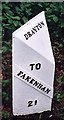
Old Milepost (east face) by the A1067, Drayton High Road, Drayton
Cast iron post by the A1067, in parish of DRAYTON (BROADLAND District), 150yds East of junction with Hurn Road. Just East of entrance to former David Rice Hospital, on the verge, near lamppost, on South side of road. Fakenham ci l-top, erected by the Norwich & Fakenham turnpike trust in the 19th century.
Inscription reads:- : TO / FAKENHAM / 21 : : TO / NORWICH / 3 : : DRAYTON :
Listed.
Milestone Society National ID: NO_NF03.
Image: © CW Haines
Taken: 13 Feb 2003
0.22 miles
6
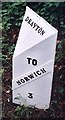
Old Milepost (west face) by the A1067, Drayton High Road, Drayton
Cast iron post by the A1067, in parish of DRAYTON (BROADLAND District), 150yds East of junction with Hurn Road. Just East of entrance to former David Rice Hospital, on the verge, near lamppost, on South side of road. Fakenham ci l-top, erected by the Norwich & Fakenham turnpike trust in the 19th century.
Inscription reads:- : TO / FAKENHAM / 21 : : TO / NORWICH / 3 : : DRAYTON :
Listed.
Milestone Society National ID: NO_NF03.
Image: © CW Haines
Taken: 13 Feb 2003
0.22 miles
7
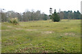
Site of the former David Rice mental hospital
Only the pampas grass suggests that this was once a garden.
Image: © Evelyn Simak
Taken: 14 Mar 2014
0.23 miles
8
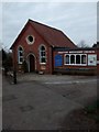
Drayton Methodist Church, Norwich, Norfolk
A small Methodist church built in 1892.
Image: © Jeremy Osborne
Taken: 9 Mar 2015
0.24 miles
9
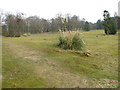
Site of the former David Rice mental hospital
One of the many paths traversing the site which is slowly reverting back to nature.
Image: © Evelyn Simak
Taken: 14 Mar 2014
0.24 miles