
IMAGES TAKEN NEAR TO
Corbet Avenue, NORWICH, NR7 8HR
Introduction
This page details the photographs taken nearby to Corbet Avenue, NR7 8HR by members of the Geograph project.
The Geograph project started in 2005 with the aim of publishing, organising and preserving representative images for every square kilometre of Great Britain, Ireland and the Isle of Man.

There are currently over 7.5m images from over14,400 individuals and you can help contribute to the project by visiting https://www.geograph.org.uk
Image Map
Images are licensed for reuse under creativecommons.org/licenses/by-sa/2.0
Notes
- Clicking on the map will re-center to the selected point.
- The higher the marker number, the further away the image location is from the centre of the postcode.
Image Listing (9 Images Found)
Images are licensed for reuse under creativecommons.org/licenses/by-sa/2.0
Image
Details
Distance
1
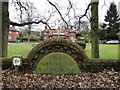
The Norfolk Regiment War Memorial
The Regimental memorial consists of four semi-detached houses or "Cottages" in a close named Memorial Cottages. They were erected after the Great War for disabled servicemen who had served and needed secure and what today would be called 'Sheltered accommodation'. They are still in use by ex members of the Royal Norfolk Regiment (Anglian Regiment) today.
A short distance away are eight more cottages erected after WW2 for the same purpose.
Image: © Adrian S Pye
Taken: 23 Jan 2018
0.12 miles
2
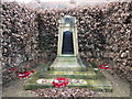
Norfolk Regiment War Memorial 1914 - 1919
The Memorial reads :
In memory of the 6000 Officers & Men of the Norfolk Regiment who fell in the Great War 1914 - 1919. These cottages were erected for disabled soldiers of the Regiment 1920.
Image: © Adrian S Pye
Taken: 23 Jan 2018
0.12 miles
3
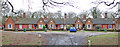
Norfolk Regiment War Memorial Cottages
Some of the six cottages which comprise the Regiment's Second World War Memorial.
The Cottages are named Europe 1939-1945, Bates, Gristock, Knowland, Randle and Asia 1942-1945.
They were intended for war veterans from the Royal Norfolk Regiment, the members of which won 5 Victoria crosses in the 2nd World War, the greatest number for any British Division in the conflict. The site was donated by the Norwich Home Guard. The houses named 'Europe' and 'Asia' refer to the theatres of war in which the regiment fought, the other four names being those of 4 of the holders of the Victoria Cross.
Image: © Adrian S Pye
Taken: 23 Jan 2018
0.19 miles
4
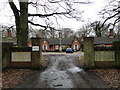
Norfolk Regiment War Memorial Cottages
See also http://www.geograph.org.uk/photo/5660187 for more details
Image: © Adrian S Pye
Taken: 23 Jan 2018
0.19 miles
5
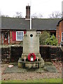
Norfolk Regiment War Memorial 1939- 1945
The Memorial reads:
In Memory of the 2025 Officers and Men of the Royal Norfolk Regiment who fell in the war of 1939 + 1945. These Cottages were erected for disabled soldiers of the Regiment. 1950
Image: © Adrian S Pye
Taken: 23 Jan 2018
0.19 miles
6

Paths diverge, Mousehold Heath
Mousehold Heath is the last remnant of a huge area of heathland that, in Tudor times, stretched as far as South Walsham and was 22 miles round. It was given to the city of Norwich in 1880 and is now managed by the city council as a nature reserve. The ill-fated rebel army of Robert Kett camped here in 1549 prior to its attack on Norwich. For more information see www.norwich.gov.uk/webapps/atoz/service_page.asp?id=1228 or http://www.bbc.co.uk/legacies/myths_legends/england/norfolk/
Image: © Jon Welch
Taken: 10 Nov 2006
0.22 miles
7

Track on Mousehold Heath
Mousehold Heath is an 88 hectare remnant of formerly extensive heathland which was given to Norwich City Council in 1880.
It is now surrounded by suburban development.
https://www.norwich.gov.uk/info/20006/sports_parks_and_leisure/1534/about_mousehold_heath
Image: © Des Blenkinsopp
Taken: 1 Aug 2021
0.23 miles
8
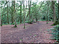
A path through Mousehold Heath
Mousehold heath once formed part of the great expanse of heathland that extended from the north-eastern bank of the River Wensum towards the villages of Salhouse and Rackheath. Originally the heath was maintained by grazing but without maintenance the trees have grown tall and the area is now a woodland much frequented by walkers. The overgrown workings of 19th century gravel, flint, lime and marl extraction can still be seen. Mousehold Heath covers nearly 200 acres (81 ha) and is much appreciated by Norwich people as a public open space.
Image: © Evelyn Simak
Taken: 11 Sep 2010
0.24 miles
9
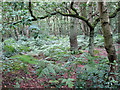
Mousehold Heath, Norwich
Mousehold heath once formed part of the great expanse of heathland that extended from the north-eastern bank of the River Wensum towards the villages of Salhouse and Rackheath. Originally the heath was maintained by grazing but without maintenance the trees have grown tall and the area is now a woodland much frequented by walkers. The overgrown workings of 19th century gravel, flint, lime and marl extraction can still be seen. Mousehold Heath covers nearly 200 acres (81 ha) and is much appreciated by Norwich people as a public open space.
Image: © Evelyn Simak
Taken: 11 Sep 2010
0.24 miles