
IMAGES TAKEN NEAR TO
Harvey Lane, NORWICH, NR7 0AQ
Introduction
This page details the photographs taken nearby to Harvey Lane, NR7 0AQ by members of the Geograph project.
The Geograph project started in 2005 with the aim of publishing, organising and preserving representative images for every square kilometre of Great Britain, Ireland and the Isle of Man.

There are currently over 7.5m images from over14,400 individuals and you can help contribute to the project by visiting https://www.geograph.org.uk
Image Map
Images are licensed for reuse under creativecommons.org/licenses/by-sa/2.0
Notes
- Clicking on the map will re-center to the selected point.
- The higher the marker number, the further away the image location is from the centre of the postcode.
Image Listing (30 Images Found)
Images are licensed for reuse under creativecommons.org/licenses/by-sa/2.0
Image
Details
Distance
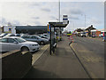
2
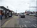
Bus stop and shelter on Plumstead Road (B1140), Norwich
Image: © JThomas
Taken: 25 Apr 2016
0.10 miles
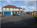
4
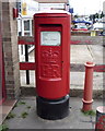
Elizabeth II postbox on Plumstead Road
Postbox No. NR1 130.
Outside the former Post Office.
Image: © JThomas
Taken: 25 Apr 2016
0.11 miles
6
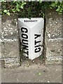
Old Boundary Marker on Plunstead Road East, Thorpe St Andrew
Municipal Boundary Marker on the south side of Plumstead Road East, set in the front garden wall of No.2. On the boundary of Norwich and Thorpe next Norwich parish, called Thorpe St Andrew parish since 1955. The marker probably dates from 1889 when the part of the parish within the city boundary was split off to help create Norwich parish.
Milestone Society National ID: NO_NORTSA01pb
Image: © A Lake
Taken: 1 Aug 2023
0.14 miles
7
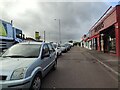
Plumstead Road shops, Norwich
The shops just off Plumstead Road in Norwich.
Image: © Sebastian Doe
Taken: 22 Oct 2020
0.14 miles
9
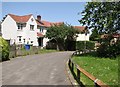
49/51 Morse Road
Morse Road is named after George Morse, the first Mayor and then Lord Mayor of Norwich. He was a brewer by trade and the director of Stuart & Pattersons brewery. He was also a mountaineer of some repute.
Image: © Evelyn Simak
Taken: 29 Jun 2019
0.17 miles
10

45/47 Morse Road
The path in the foreground leads to Newbegin Close. Morse Road is named after George Morse, the first Mayor and then Lord Mayor of Norwich. He was a brewer by trade and the director of Stuart & Pattersons brewery. He was also a mountaineer of some repute.
Image: © Evelyn Simak
Taken: 29 Jun 2019
0.17 miles