Old Boundary Marker on Plunstead Road East, Thorpe St Andrew
Introduction
The photograph on this page of Old Boundary Marker on Plunstead Road East, Thorpe St Andrew by A Lake as part of the Geograph project.
The Geograph project started in 2005 with the aim of publishing, organising and preserving representative images for every square kilometre of Great Britain, Ireland and the Isle of Man.

There are currently over 7.5m images from over 14,400 individuals and you can help contribute to the project by visiting https://www.geograph.org.uk
Old Boundary Marker on Plunstead Road East, Thorpe St Andrew
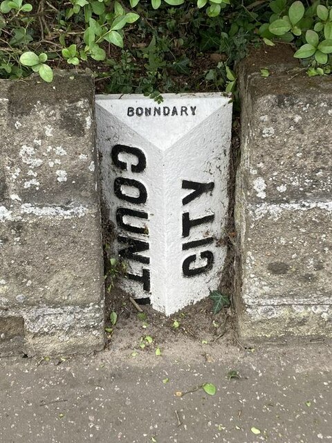
Image: © A Lake Taken: 1 Aug 2023
Municipal Boundary Marker on the south side of Plumstead Road East, set in the front garden wall of No.2. On the boundary of Norwich and Thorpe next Norwich parish, called Thorpe St Andrew parish since 1955. The marker probably dates from 1889 when the part of the parish within the city boundary was split off to help create Norwich parish. Milestone Society National ID: NO_NORTSA01pb
Images are licensed for reuse under creativecommons.org/licenses/by-sa/2.0
Image Location
Latitude
52.637539
Longitude
1.329927