
IMAGES TAKEN NEAR TO
Belsey Bridge Road, BUNGAY, NR35 2JT
Introduction
This page details the photographs taken nearby to Belsey Bridge Road, NR35 2JT by members of the Geograph project.
The Geograph project started in 2005 with the aim of publishing, organising and preserving representative images for every square kilometre of Great Britain, Ireland and the Isle of Man.

There are currently over 7.5m images from over14,400 individuals and you can help contribute to the project by visiting https://www.geograph.org.uk
Image Map
Images are licensed for reuse under creativecommons.org/licenses/by-sa/2.0
Notes
- Clicking on the map will re-center to the selected point.
- The higher the marker number, the further away the image location is from the centre of the postcode.
Image Listing (18 Images Found)
Images are licensed for reuse under creativecommons.org/licenses/by-sa/2.0
Image
Details
Distance
1

Hall Farm
This was taken during a charity walk around the Ditchingham Estate, which allowed access to areas away from the public footpath. This farm track is also the route of the footpath that runs through the estate.
Image: © Glen Denny
Taken: 4 May 2014
0.08 miles
2

Tindall Wood
A crop of maize in the foreground.
Image: © Jonathan Billinger
Taken: 21 Jun 2007
0.08 miles
3

Hall Farm - farmhouse
This view was taken from the public footpath which leads from Church Road in Hedenham first easterly past Hall Farm and then in southerly direction to the village of Ditchingham.
Image: © Evelyn Simak
Taken: 18 Jul 2009
0.10 miles
4

Hall Farm
This was taken during a charity walk around the Ditchingham Estate, which allowed access to areas away from the public footpath.
Image: © Glen Denny
Taken: 4 May 2014
0.10 miles
5

Hall Farm
This view was taken from the public footpath which leads from Church Road in Hedenham first easterly past Hall Farm and then in southerly direction to the village of Ditchingham.
Image: © Evelyn Simak
Taken: 18 Jul 2009
0.11 miles
6

Farm Track beside Tindall Wood
This farm track is also a footpath.
Image: © Glen Denny
Taken: 4 May 2014
0.12 miles
7

Farm track skirting Tindall Wood
Tindall Wood is a site of special scientific interest (SSSI) and one of the largest hornbeam woods in the county. It is an ancient woodland situated on poorly drained south Norfolk boulder clay which is overlain in places by sandy loam. Surrounded by a massive woodbank and ditch, the wood mainly supports hornbeam and oak but ash, maple and hazel can also be found. Several uncommon species which are found in the ground flora indicate that the wood may be primary. The wood is not open to the public.
Image: © Evelyn Simak
Taken: 16 Feb 2017
0.15 miles
8

Trees growing along ditch
Hall Farm can be seen in the background (at left).
Image: © Evelyn Simak
Taken: 18 Jul 2009
0.16 miles
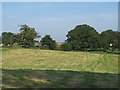
10

Path to Ditchingham
This public footpath leads from Church Road in Hedenham first easterly past Hall Farm (which can be seen in the background) and then in southerly direction to the village of Ditchingham.
Image: © Evelyn Simak
Taken: 18 Jul 2009
0.18 miles