IMAGES TAKEN NEAR TO
Second Avenue, GREAT YARMOUTH, NR30 5NW
Introduction
This page details the photographs taken nearby to Second Avenue, NR30 5NW by members of the Geograph project.
The Geograph project started in 2005 with the aim of publishing, organising and preserving representative images for every square kilometre of Great Britain, Ireland and the Isle of Man.

There are currently over 7.5m images from over14,400 individuals and you can help contribute to the project by visiting https://www.geograph.org.uk
Image Map
Images are licensed for reuse under creativecommons.org/licenses/by-sa/2.0
Notes
- Clicking on the map will re-center to the selected point.
- The higher the marker number, the further away the image location is from the centre of the postcode.
Image Listing (22 Images Found)
Images are licensed for reuse under creativecommons.org/licenses/by-sa/2.0
Image
Details
Distance
3
A SANDY beach
Always a big plus, as here in Caister
Image: © Basher Eyre
Taken: 30 Jul 2016
0.09 miles
6
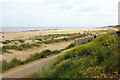
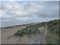
Dunes & Beach - Caister
Looking down from the dunes, and along the beach. The lower footpath is a tarmacked surface, which is ideal for wheelchairs and the easy stroll. To the right, and out of view from the position where I took the photo, is a small car-park, accessed from the end of Second Avenue.
Image: © Richard Robinson
Taken: 13 Jun 2007
0.09 miles

8
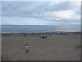
Looking towards some wind turbines at Caister
Image: © Basher Eyre
Taken: 30 Jul 2016
0.10 miles
9
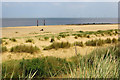
Caister Beach
View of Caister beach from the lower footpath. The windfarm on Scroby Sands in the North Sea spanning the photo’s horizon is at a distance of 2.5 kilometres from the coast. ‘Fact File’ (Each turbine tower is 60m high, weighs approximately 200 tonnes and has 40m long blades… the foundations are 4m diameter steel cylinders…) the source of information was taken from a Powergen hoarding. The photo’s vertical centre line taken from a compass is 114 degrees ESE of magnetic North.
Image: © Richard Robinson
Taken: 13 Jun 2007
0.12 miles