
IMAGES TAKEN NEAR TO
Tower Road, GREAT YARMOUTH, NR29 3AU
Introduction
This page details the photographs taken nearby to Tower Road, NR29 3AU by members of the Geograph project.
The Geograph project started in 2005 with the aim of publishing, organising and preserving representative images for every square kilometre of Great Britain, Ireland and the Isle of Man.

There are currently over 7.5m images from over14,400 individuals and you can help contribute to the project by visiting https://www.geograph.org.uk
Image Map
Images are licensed for reuse under creativecommons.org/licenses/by-sa/2.0
Notes
- Clicking on the map will re-center to the selected point.
- The higher the marker number, the further away the image location is from the centre of the postcode.
Image Listing (50 Images Found)
Images are licensed for reuse under creativecommons.org/licenses/by-sa/2.0
Image
Details
Distance
1
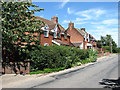
Cottages on Town Road
The village of Burgh St Margaret, also called Fleggburgh. It is thought that Burgh was the original name but with altogether four Norfolk villages called 'Burgh' it became necessary to distinguish between them. The adjoining parish used to be called Burgh Vaux or Burgh St Mary, the latter adopting the name of their church > http://www.geograph.org.uk/photo/376316 - in ruins since the 16th century - only the round tower remains. Fleggburgh/Burgh St Margaret is located on the A1064, the main route linking Acle to West Yarmouth before the opening of the Acle Straight (A47/New Road) as a toll road in 1831.
Image: © Evelyn Simak
Taken: 22 Jun 2008
0.16 miles
3
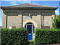
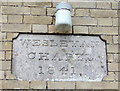
Wesleyan Chapel
This Wesleyan chapel was built of gault brick; the plaque above its door gives the year of its construction as 1841. The chapel is located in Town Road.
Image: © Evelyn Simak
Taken: 22 Jun 2008
0.19 miles
4
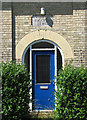
Wesleyan Chapel - door
This Wesleyan chapel > http://www.geograph.org.uk/photo/855821 - http://www.geograph.org.uk/photo/855823 was built of gault brick; the plaque above its door gives the year of its construction as 1841. The chapel is located in Town Road.
Image: © Evelyn Simak
Taken: 22 Jun 2008
0.19 miles
5
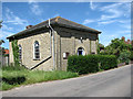
Wesleyan Chapel
This Wesleyan chapel was built of gault brick; the plaque above its door gives the year of its construction as 1841. The chapel is located in Town Road.
Image: © Evelyn Simak
Taken: 22 Jun 2008
0.19 miles
6
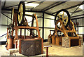
Former Fleggburgh Village - steam engines
These two vertical duplex steam engines were built to drive Appold centrifugal pumps for fen drainage and were displayed at this museum until its eventual closure. They are currently with Preston Services near Canterbury and are for sale. The furthest from the camera was used on Haddiscoe Marshes and was built c1870 by Easton, Amos & Anderson. The closest was used at West Somerton and built in 1866 by Easton, Amos & Sons. They are typical of that company's land drainage engine and further examples survive on the Somerset Levels.
Image: © Chris Allen
Taken: 18 Jun 1993
0.19 miles
7

Steam pumping engine, Bygones Village, Fleggburgh
This was an excellent tourist attraction that sadly closed some years ago and the collection was dispersed. This land drainage pump and a similar one alongside it (just visible in the background) were relocated to Preston near Canterbury and are for sale. They appear in a Geograph of that site Image
They are similar to those surviving at Westonzoyland and Curry Moor in Somerset.
Image: © Chris Allen
Taken: 18 Jun 1993
0.20 miles
8
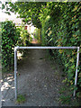
A shady path
This path turns off Town Road; it leads in southerly direction and links with the A1064 by St Margaret's church > http://www.geograph.org.uk/photo/855777. For its other end see > http://www.geograph.org.uk/photo/855839.
Image: © Evelyn Simak
Taken: 22 Jun 2008
0.20 miles
10

Burgh St. Margaret village sign
Also these day more often called Fleggburgh, the elaborate sign stands in the entrance to the village hall or community centre as is the common parlance. It takes the form of a thatched roof over the double sided carved wooden sign. The east face is shown in the general view and bears the date 1527, in between the sails of a windmill and a cottage loaf of bread, which is flanked by two sheaves of wheat. The illustration is depicted with the background of a one penny piece, referring to the late Edward Peake who died in 1705. He bequeathed a Penny Loaf to be given to each child attending the village primary school, a tradition still carried out today.
The west face depicts the church of St Margaret, some trees including a pollarded willow within an agricultural scene by a river.
https://www.geograph.org.uk/photo/6668265
https://www.geograph.org.uk/photo/6668261
Image: © Adrian S Pye
Taken: 7 Nov 2020
0.20 miles