
IMAGES TAKEN NEAR TO
Hollow Tree Way, MELTON CONSTABLE, NR24 2SA
Introduction
This page details the photographs taken nearby to Hollow Tree Way, NR24 2SA by members of the Geograph project.
The Geograph project started in 2005 with the aim of publishing, organising and preserving representative images for every square kilometre of Great Britain, Ireland and the Isle of Man.

There are currently over 7.5m images from over14,400 individuals and you can help contribute to the project by visiting https://www.geograph.org.uk
Image Map
Images are licensed for reuse under creativecommons.org/licenses/by-sa/2.0
Notes
- Clicking on the map will re-center to the selected point.
- The higher the marker number, the further away the image location is from the centre of the postcode.
Image Listing (9 Images Found)
Images are licensed for reuse under creativecommons.org/licenses/by-sa/2.0
Image
Details
Distance
3
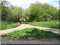
Rural crossroads
None of these country lanes has a name - the road seen straight ahead links with Hall Street further to the east. The bridge seen in mid-distance takes the road over the River Bure which here is nothing more than a small stream > http://www.geograph.org.uk/photo/1278078. The stream here crosses the lane via a culvert which runs underneath it, only to cross underneath another lane at the same junction about 20 metres further to the west > http://www.geograph.org.uk/photo/1278144.
The River Bure rises near Melton Constable, 18 kilometres miles upstream of Aylsham, which was the original head of navigation. It flows into the North Sea by Breydon Water near Gorleston, further to the southeast.
Image: © Evelyn Simak
Taken: 29 Apr 2009
0.19 miles
4
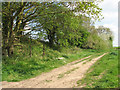
Track beside railway embankment
The track seen in foreground doubles as a public footpath. It follows an embankment which once used to carry the Midland and Great Northern Railway line. The trackbed has since been dismantled.
Briston and Melton Constable merge into each other and if it were not for the village sign it would be difficult to discern where the one ends and the other begins. For 50 years Melton Constable was the hub of a network of railway lines which were operated by the Midland and Great Northern Railway and left from Melton station in four directions. As recently as 1956, 32 trains per day passed through the station. A victim of the Beeching cuts, the last passenger train arrived on 4. April 1964.
Image: © Evelyn Simak
Taken: 29 Apr 2009
0.20 miles
6
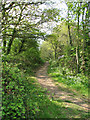
Path along dismantled railway
This narrow path follows a short section of the former railway embankment which once used to carry the Midland and Great Northern Railway line. The trackbed has since been dismantled.
Briston and Melton Constable merge into each other and if it were not for the village sign it would be difficult to discern where the one ends and the other begins. For 50 years Melton Constable was the hub of a network of railway lines which were operated by the Midland and Great Northern Railway and left from Melton station in four directions. As recently as 1956, 32 trains per day passed through the station. A victim of the Beeching cuts, the last passenger train arrived on 4. April 1964.
Image: © Evelyn Simak
Taken: 29 Apr 2009
0.22 miles
7
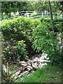
Flytip in stream
The small stream seen here is the River Bure which rises near Melton Constable, 18 kilometres miles upstream of Aylsham, which was the original head of navigation. It flows into the North Sea by Breydon Water near Gorleston, further to the southeast. The railings seen in the background belong to a bridge which takes a rural lane over the stream and northwards to the B1354 (Fakenham Road) > http://www.geograph.org.uk/photo/1278144.
Image: © Evelyn Simak
Taken: 29 Apr 2009
0.23 miles
8
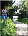
Disused railway bridge
This bridge used to carry trains of the Midland and Great Northern Railway line over a rural lane. The trackbed has since been dismantled.
Briston and Melton Constable merge into each other and if it were not for the village sign it would be difficult to discern where the one ends and the other begins. For 50 years Melton Constable was the hub of a network of railway lines which were operated by the Midland and Great Northern Railway and left from Melton station in four directions. As recently as 1956, 32 trains per day passed through the station. A victim of the Beeching cuts, the last passenger train arrived on 4. April 1964.
Image: © Evelyn Simak
Taken: 29 Apr 2009
0.24 miles
9
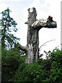
The trunk of a dead tree
It is towering over the surrounding vegetation which is growing beside the River Bure which here is only a small stream > http://www.geograph.org.uk/photo/1278154.
Image: © Evelyn Simak
Taken: 29 Apr 2009
0.25 miles