IMAGES TAKEN NEAR TO
The Street, FAKENHAM, NR21 0PR
Introduction
This page details the photographs taken nearby to The Street, NR21 0PR by members of the Geograph project.
The Geograph project started in 2005 with the aim of publishing, organising and preserving representative images for every square kilometre of Great Britain, Ireland and the Isle of Man.

There are currently over 7.5m images from over14,400 individuals and you can help contribute to the project by visiting https://www.geograph.org.uk
Image Map
Images are licensed for reuse under creativecommons.org/licenses/by-sa/2.0
Notes
- Clicking on the map will re-center to the selected point.
- The higher the marker number, the further away the image location is from the centre of the postcode.
Image Listing (32 Images Found)
Images are licensed for reuse under creativecommons.org/licenses/by-sa/2.0
Image
Details
Distance
1
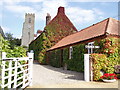
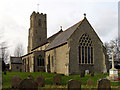
Hindringham Church
The tiny north Norfolk village of Hindringham - without a pub or a shop - is dominated by St Martin's Church. From the top of the tower, the North Sea at Stiffkey can just about be seen.
Image: © David Williams
Taken: 9 Sep 2006
0.04 miles
2
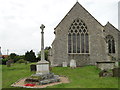
Hindringham War Memorial
The memorial which stands at the east of the church bears eleven names from WW1 and one from WW2. The complete Roll of Honour in the church has the names of all 73 men from the village who served in WW1.
Image: © Adrian S Pye
Taken: 23 Jul 2015
0.11 miles
3
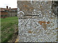
Bench mark on Hindringham St Martin's church
The cut mark is on the south-east buttress of the chancel. It is about 65cms above ground level facing north-east. For more information on this and other bench marks visit the bench mark database > http://www.bench-marks.org.uk/bm35298. For a view of the church, click this link > http://www.geograph.org.uk/photo/2031409
Image: © Adrian S Pye
Taken: 24 Aug 2010
0.11 miles
4
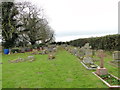
The graveyard to the north of Hindringham church
Image: © Adrian S Pye
Taken: 2 Dec 2017
0.12 miles
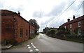
6
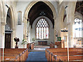
St Martin's church in Hindringham - view east
St Martin's church > http://www.geograph.org.uk/photo/2032389 is situated on an elevation above the main road through the village of Hindringham. The church as we see it today dates mainly from the 14th century but was extensively restored in Victorian times. The building houses the original 15th century baptismal font > http://www.geograph.org.uk/photo/2032415 and what is believed to be the oldest parish chest in England, dating from the 12th century > http://www.geograph.org.uk/photo/2032428. It is featured on the village sign > http://www.geograph.org.uk/photo/2031423. The decoration on the chest is accepted as the nearest indication of the type of adornment found on strongboxes of Norman times.
Image: © Evelyn Simak
Taken: 24 Aug 2010
0.13 miles
7
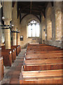
St Martin's church in Hindringham - south aisle
St Martin's church > http://www.geograph.org.uk/photo/2032389 is situated on an elevation above the main road through the village of Hindringham. The church as we see it today dates mainly from the 14th century but was extensively restored in Victorian times. The building houses the original 15th century baptismal font > http://www.geograph.org.uk/photo/2032415 and what is believed to be the oldest parish chest in England, dating from the 12th century > http://www.geograph.org.uk/photo/2032428. It is featured on the village sign > http://www.geograph.org.uk/photo/2031423. The decoration on the chest is accepted as the nearest indication of the type of adornment found on strongboxes of Norman times.
Image: © Evelyn Simak
Taken: 24 Aug 2010
0.13 miles
8
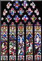
St Martin's church in Hindringham - east window
St Martin's church > http://www.geograph.org.uk/photo/2032389 is situated on an elevation above the main road through the village of Hindringham. The church as we see it today dates mainly from the 14th century but was extensively restored in Victorian times. The building houses the original 15th century baptismal font > http://www.geograph.org.uk/photo/2032415 and what is believed to be the oldest parish chest in England, dating from the 12th century > http://www.geograph.org.uk/photo/2032428. It is featured on the village sign > http://www.geograph.org.uk/photo/2031423. The decoration on the chest is accepted as the nearest indication of the type of adornment found on strongboxes of Norman times.
Image: © Evelyn Simak
Taken: 24 Aug 2010
0.13 miles