
IMAGES TAKEN NEAR TO
St. Andrews Drive, NORWICH, NR16 2TB
Introduction
This page details the photographs taken nearby to St. Andrews Drive, NR16 2TB by members of the Geograph project.
The Geograph project started in 2005 with the aim of publishing, organising and preserving representative images for every square kilometre of Great Britain, Ireland and the Isle of Man.

There are currently over 7.5m images from over14,400 individuals and you can help contribute to the project by visiting https://www.geograph.org.uk
Image Map
Images are licensed for reuse under creativecommons.org/licenses/by-sa/2.0
Notes
- Clicking on the map will re-center to the selected point.
- The higher the marker number, the further away the image location is from the centre of the postcode.
Image Listing (21 Images Found)
Images are licensed for reuse under creativecommons.org/licenses/by-sa/2.0
Image
Details
Distance
1

Eccles Road Station - the signal box
Eccles Road railway station > http://www.geograph.org.uk/photo/1398991 is served by local services operated by East Midlands Trains and National Express East Anglia running from Norwich to Peterborough and Cambridge. The station is unstaffed and has two platforms adjacent to a level crossing which is manually controlled > http://www.geograph.org.uk/photo/1398996. The staffed ex-GER (Great Eastern Railway) signal box is located across the road from the west-bound platform. The old village of Eccles was abandoned and only St Mary's church > http://www.geograph.org.uk/photo/1399018still stands on the site. The new village was built by the railway station
Image: © Evelyn Simak
Taken: 13 Jul 2009
0.04 miles
2
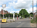
View north along Station Road
In the foreground the level crossing at Eccles Road Station > http://www.geograph.org.uk/photo/1398991 can be seen.
Image: © Evelyn Simak
Taken: 13 Jul 2009
0.05 miles
3

Track running parallel with the railway line
The signal box at Eccles Road Station > http://www.geograph.org.uk/photo/1398991 can just be glimpsed at left.
Image: © Evelyn Simak
Taken: 13 Jul 2009
0.05 miles
4

Level crossing on Station Road
Eccles Road railway station is served by local services operated by East Midlands Trains and National Express East Anglia running from Norwich to Peterborough and Cambridge. The station is unstaffed and has two platforms adjacent to a level crossing which is manually controlled > http://www.geograph.org.uk/photo/1398996. The staffed ex-GER (Great Eastern Railway) signal box > http://www.geograph.org.uk/photo/1399004 is located across the road from the west-bound platform. The old village of Eccles was abandoned and only St Mary's church > http://www.geograph.org.uk/photo/1399018 still stands on the site. The new village was built by the railway station.
Image: © Evelyn Simak
Taken: 13 Jul 2009
0.06 miles
5

Eccles Road Station - the signal box
Eccles Road railway station > http://www.geograph.org.uk/photo/1398991 is served by local services operated by East Midlands Trains and National Express East Anglia running from Norwich to Peterborough and Cambridge. The station is unstaffed and has two platforms adjacent to a level crossing which is manually controlled > http://www.geograph.org.uk/photo/1398996. The staffed ex-GER (Great Eastern Railway) signal box is located across the road from the west-bound platform. The old village of Eccles was abandoned and only St Mary's church > http://www.geograph.org.uk/photo/1399018 still stands on the site. The new village was built by the railway station
Image: © Evelyn Simak
Taken: 13 Jul 2009
0.06 miles
6
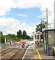
Eccles Road Station - opening of the crossing gates
A train has just passed and the signalman has come out of the signal box in order to open the crossing gates on Station Road where the first of the waiting cars can be seen crossing the railway tracks.
Eccles Road railway station is served by local services operated by East Midlands Trains and National Express East Anglia running from Norwich to Peterborough and Cambridge. The station is unstaffed and has two platforms adjacent to a level crossing which is manually controlled. The staffed ex-GER (Great Eastern Railway) signal box > http://www.geograph.org.uk/photo/1399004 is located across the road from the west-bound platform. The old village of Eccles was abandoned and only St Mary's church > http://www.geograph.org.uk/photo/1399018 still stands on the site. The new village was built by the railway station.
Image: © Evelyn Simak
Taken: 13 Jul 2009
0.07 miles
7
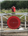
Eccles Road Station - crossing gates (detail)
For a wider view of this location see > http://www.geograph.org.uk/photo/1399010.
Image: © Evelyn Simak
Taken: 13 Jul 2009
0.07 miles
8
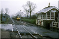
Eccles Road crossing in the rain
Looking towards Norwich the last class 40 in operation 40122 (D200) on the railway is seen approaching the station from Norwich with a special service to York.
Image: © roger geach
Taken: 16 Apr 1988
0.07 miles
9
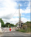
Level crossing by Eccles Road Station
A train is approaching and the crossing gates on Station Road have just been closed. The signal box can be seen at right. See > http://www.geograph.org.uk/photo/1398991 for a view of the railway station.
Image: © Evelyn Simak
Taken: 13 Jul 2009
0.08 miles
10

Eccles Road Station - the signal box
Eccles Road railway station > http://www.geograph.org.uk/photo/1398991 is served by local services operated by East Midlands Trains and National Express East Anglia running from Norwich to Peterborough and Cambridge. The station is unstaffed and has two platforms adjacent to a level crossing which is manually controlled > http://www.geograph.org.uk/photo/1398996. The staffed ex-GER (Great Eastern Railway) signal box is located across the road from the west-bound platform. The old village of Eccles was abandoned and only St Mary's church > http://www.geograph.org.uk/photo/1399018 still stands on the site. The new village was built by the railway station
Image: © Evelyn Simak
Taken: 13 Jul 2009
0.09 miles