
Eccles Road Station - the signal box
Introduction
The photograph on this page of Eccles Road Station - the signal box by Evelyn Simak as part of the Geograph project.
The Geograph project started in 2005 with the aim of publishing, organising and preserving representative images for every square kilometre of Great Britain, Ireland and the Isle of Man.

There are currently over 7.5m images from over 14,400 individuals and you can help contribute to the project by visiting https://www.geograph.org.uk
Eccles Road Station - the signal box
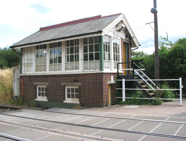
Image: © Evelyn Simak Taken: 13 Jul 2009
Eccles Road railway station > http://www.geograph.org.uk/photo/1398991 is served by local services operated by East Midlands Trains and National Express East Anglia running from Norwich to Peterborough and Cambridge. The station is unstaffed and has two platforms adjacent to a level crossing which is manually controlled > http://www.geograph.org.uk/photo/1398996. The staffed ex-GER (Great Eastern Railway) signal box is located across the road from the west-bound platform. The old village of Eccles was abandoned and only St Mary's church > http://www.geograph.org.uk/photo/1399018 still stands on the site. The new village was built by the railway station
Images are licensed for reuse under creativecommons.org/licenses/by-sa/2.0
Image Location

Latitude
52.471485
Longitude
0.970989