
IMAGES TAKEN NEAR TO
St. Leonards Road, NORWICH, NR1 4BT
Introduction
This page details the photographs taken nearby to St. Leonards Road, NR1 4BT by members of the Geograph project.
The Geograph project started in 2005 with the aim of publishing, organising and preserving representative images for every square kilometre of Great Britain, Ireland and the Isle of Man.

There are currently over 7.5m images from over14,400 individuals and you can help contribute to the project by visiting https://www.geograph.org.uk
Image Map
Images are licensed for reuse under creativecommons.org/licenses/by-sa/2.0
Notes
- Clicking on the map will re-center to the selected point.
- The higher the marker number, the further away the image location is from the centre of the postcode.
Image Listing (2571 Images Found)
Images are licensed for reuse under creativecommons.org/licenses/by-sa/2.0
Image
Details
Distance
1

View north along Ella Road
Approaching the junction with St Leonards Road. Ella Road is one of the six roads in the area named after Isaac Bugg Coaks' daughters. It links Hill House and St Leonards roads.
Image: © Evelyn Simak
Taken: 1 Jul 2019
0.01 miles
2

Grit bin on Ella Road
Ella Road is one of the six roads in the area named after Isaac Bugg Coaks' daughters. The terrace in the background is situated on St Leonards Road.
Image: © Evelyn Simak
Taken: 1 Jul 2019
0.01 miles
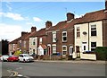
4
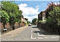
View east along St Leonards Road
From the junction with Rosary Road.
Image: © Evelyn Simak
Taken: 1 Jul 2019
0.01 miles
5
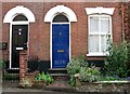
Terrace on St Leonards Road (entrances)
The terrace dates from the late 19th century.
Image: © Evelyn Simak
Taken: 1 Jul 2019
0.02 miles
6
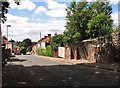
View west along St Leonards Road
Downhill all the way to the junction with Rosary Road. Note the old buttressed flint wall at right.
Image: © Evelyn Simak
Taken: 1 Jul 2019
0.02 miles
7
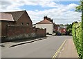
View west along St Leonards Road
This view gives an idea as to how much higher this area is as compared with the Norwich city centre: Norwich Castle > https://www.geograph.org.uk/photo/5819211 can be seen above the roof of the pink house furthest away from the photographer and the tall tower to its right is the tower of City Hall > https://www.geograph.org.uk/photo/5876513 and to its right, and behind, there is the top of the Winchester Tower > https://www.geograph.org.uk/photo/5824443.
Image: © Evelyn Simak
Taken: 1 Jul 2019
0.02 miles
8
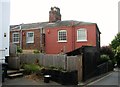
The rear of a terrace by the St Leonards/Rosary roads junction
Image: © Evelyn Simak
Taken: 1 Jul 2019
0.02 miles
9

Side entrance to the Ellacombe care home
This entrance is on St Leonards Road. Note the old firepoint marker plate on the gate post > https://www.geograph.org.uk/photo/6198917.
The care home's brochure informs that Ellacombe > https://www.geograph.org.uk/photo/6198908 is a residential care home with 42 rooms and stunning cathedral views. Certainly nobody will see anything from here. The home provides specialist care for up to 45 people and supports people living with dementia, high physical dependency needs and residential care. Its name is presumably derived from its location, which is Ella Road, one of the six roads in the area named after Isaac Bugg Coaks daughters.
Image: © Evelyn Simak
Taken: 1 Jul 2019
0.03 miles
10

Old firepoint marker plate on a gate post
For a wider view of this location and some information see > https://www.geograph.org.uk/photo/6198914.
Image: © Evelyn Simak
Taken: 1 Jul 2019
0.03 miles