IMAGES TAKEN NEAR TO
Yare Valley Rise, NORWICH, NR13 5JW
Introduction
This page details the photographs taken nearby to Yare Valley Rise, NR13 5JW by members of the Geograph project.
The Geograph project started in 2005 with the aim of publishing, organising and preserving representative images for every square kilometre of Great Britain, Ireland and the Isle of Man.

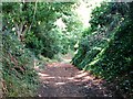
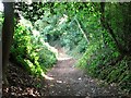
There are currently over 7.5m images from over14,400 individuals and you can help contribute to the project by visiting https://www.geograph.org.uk
Image Map
Images are licensed for reuse under creativecommons.org/licenses/by-sa/2.0
Notes
- Clicking on the map will re-center to the selected point.
- The higher the marker number, the further away the image location is from the centre of the postcode.
Image Listing (117 Images Found)
Images are licensed for reuse under creativecommons.org/licenses/by-sa/2.0
Image
Details
Distance
1
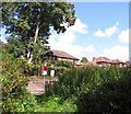
Houses above the railway line skirting Brundall
Image: © Evelyn Simak
Taken: 17 Aug 2017
0.02 miles
2
To the Church Fen local nature reserve on Church Lane
The lane ends at the crossing of the railway line > http://www.geograph.org.uk/photo/5502005 which forms the northern boundary of the reserve.
Image: © Evelyn Simak
Taken: 17 Aug 2017
0.04 miles
3
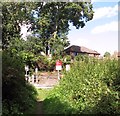
Railway crossing to Church Lane
This view was taken from the end of the path traversing the Church Fen local nature reserve.
Image: © Evelyn Simak
Taken: 17 Aug 2017
0.04 miles
4
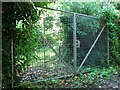
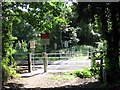
Double gates in Church Lane
If you look closely you can see not one but two security gates about 1m apart.
Image: © Evelyn Simak
Taken: 17 Aug 2017
0.04 miles
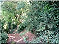
5
Uphill on Church Lane
The lane leads past the church of St Laurence > http://www.geograph.org.uk/photo/861834 and to The Street from there.
Image: © Evelyn Simak
Taken: 17 Aug 2017
0.04 miles
6
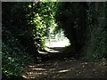
Approaching the end of Church Lane
The lane ends at the railway crossing gates which lead into the Church Fen local nature reserve.
Image: © Evelyn Simak
Taken: 17 Aug 2017
0.05 miles
7
Railway crossing at the end of Church Lane
The Church Fen local nature reserve starts on the other side of the railway line.
Image: © Evelyn Simak
Taken: 17 Aug 2017
0.05 miles
8
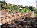
View east along the railway line at Brundall
The next stop in this direction is at Brundall station > http://www.geograph.org.uk/photo/1531824.
Image: © Evelyn Simak
Taken: 17 Aug 2017
0.05 miles
9
View along Church Lane
The lane leads to a railway crossing and the Church Fen local nature reserve beyond.
Image: © Evelyn Simak
Taken: 17 Aug 2017
0.05 miles
10
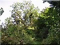
An old ash tree on the edge of Church Fen
Seen from the end of the path traversing the local nature reserve.
Image: © Evelyn Simak
Taken: 17 Aug 2017
0.05 miles