1
Geese grazing
Greylag geese and their almost fully grown offspring are keeping the grass short here by the staithe; the bird seen in the foreground is keeping an eye on, and occasionally hissing at, the photographer. The view is upstream along the River Bure.
Image: © Evelyn Simak
Taken: 30 Jul 2008
0.02 miles
2
Pay and display car park
By the staithe; the road seen in the foreground is Lower Street. The village of Horning is situated on the northern bank of the River Bure, stretching for about a mile. Lower Street, its main thoroughfare, runs parallel to the river; it is lined with shops, restaurants, B&B establishments and attractive houses and cottages. The history of Horning dates back to 1020 when the manor was given by King Canute to the newly founded Abbey of St Benet.
Image: © Evelyn Simak
Taken: 30 Jul 2008
0.05 miles
3
Quiet moorings in Horning
Image: © Alan Reid
Taken: 11 Jul 2018
0.06 miles
4
View along Lower Street
As it heads out of the village in northwesterly direction.
The village of Horning is situated on the northern bank of the River Bure, stretching for about a mile. Lower Street, its main thoroughfare, runs parallel to the river; it is lined with shops, restaurants, B&B establishments and attractive houses and cottages. The history of Horning dates back to 1020 when the manor was given by King Canute to the newly founded Abbey of St Benet.
Image: © Evelyn Simak
Taken: 30 Jul 2008
0.08 miles
5
Horning Sailing Club and River Bure
Image: © Chris Morgan
Taken: 9 Apr 2022
0.09 miles
6
Horning by the Swan Inn
Image: © Chris Morgan
Taken: 9 Apr 2022
0.09 miles
7
View towards the River Bure
Where it takes a sharp bend, changing direction from northwesterly to southwesterly as it flows through the village of Horning. Although many people were out enjoying this warm sunny day in late July these restaurant tables were empty.
The village of Horning is situated on the northern bank of the River Bure, stretching for about a mile. Lower Street, its main thoroughfare, runs parallel to the river; it is lined with shops, restaurants, B&B establishments and attractive houses and cottages. The history of Horning dates back to 1020 when the manor was given by King Canute to the newly founded Abbey of St Benet.
Image: © Evelyn Simak
Taken: 30 Jul 2008
0.09 miles
8
Horning - Moorings
Moorings off the River Bure in the holiday village of Horning.
www.broads.co.uk
Image: © Colin Smith
Taken: 18 Aug 2020
0.09 miles
9
Horning: Feeding the Pink-footed geese 'Anser brachyrhynchus'
Image: © Michael Garlick
Taken: 11 Jun 2023
0.10 miles
10
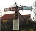
Horning village sign
Another sign which would benefit from some detergent. It depicts, on the wings, the church, a sailing yacht and a windpump. On the post is understood to be the crest of the bishop of St Benet’s abbey at Hulme or Holm. https://www.geograph.org.uk/photo/6704918
Image: © Adrian S Pye
Taken: 14 Dec 2020
0.10 miles


