1
Bridge over former railway near Govilon
The now cycle path was once the Merthyr, Tredegar & Abergavenny Railway.
Image: © Gareth James
Taken: 27 Nov 2010
0.02 miles
2
Station House, Govilon
Modernised private residence, formerly Govilon Station House. Govilon railway station was closed when passenger services on the Abergavenny to Merthyr line ceased in 1958.
Image: © Jaggery
Taken: 22 Oct 2010
0.02 miles
3
Former railway bridge, Govilon
The bridge, from Station Road to School Lane, formerly crossed above the Abergavenny to Merthyr railway line, about 100 metres to the west of Govilon Station. The station closed in 1958 on the cessation of passenger services on the route.
Image: © Jaggery
Taken: 22 Oct 2010
0.02 miles
4
Part of Govilon above the canal
Wherever you go in Govilon the canal is never far away as it snakes through the modern day village.
Image: © Jeremy Bolwell
Taken: 30 Oct 2016
0.03 miles
5
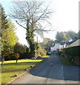
School Lane, Govilon
The view east from near the former railway bridge. http://www.geograph.org.uk/photo/2159220
Image: © Jaggery
Taken: 22 Oct 2010
0.04 miles
6
Hen Ysgoldy Gofilon / Govilon Old Schoolhouse
Yr Hen Ysgoldy Gofilon sy bellach yn dy preifat.
Yr Hen Ysgoldy (trans. old schoolhouse) in Govilon which is now a private residence.
Image: © Alan Richards
Taken: 28 Oct 1997
0.05 miles
7
Corner of Pen Padrig and Station Road, Govilon
Houses viewed across Station Road.
Image: © Jaggery
Taken: 22 Oct 2010
0.07 miles
8
The former Govilon station
The now cycle path was once the Merthyr, Tredegar & Abergavenny Railway.
Image: © Gareth James
Taken: 27 Nov 2010
0.08 miles
9
Cycle route at former Govilon Station
The former railway station has been converted to a private house and walled of from the dismantled railway which is now a road and part of NCR 46.
Image: © M J Roscoe
Taken: 13 Jul 2019
0.08 miles
10
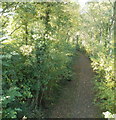
Footpath along railbed, Govilon
Viewed from the bridge http://www.geograph.org.uk/photo/2159220 connecting Station Road and School Lane. The footpath heads west along the route of the Abergavenny to Merthyr Tydfil railway line. Govilon station was about 100 metres behind the camera. Passenger services ceased in 1958.
Image: © Jaggery
Taken: 22 Oct 2010
0.09 miles


