1
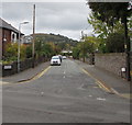
North along Belgrave Road, Abergavenny
From the A40 Brecon Road.
Image: © Jaggery
Taken: 29 Dec 2019
0.04 miles
2
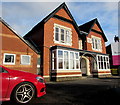
Rozelle Nursing Home, 93 Brecon Road, Abergavenny
On the north side of the A40 in the west of Abergavenny.
Image: © Jaggery
Taken: 29 Dec 2019
0.06 miles
3
The Knoll, Brecon Road, Abergavenny
This little hillock I think dates from post glacial times when it was left by meltwaters in this part of the Usk Valley. Maybe the Normans used it to control the road into and out of Abergavenny? It has always been in someone's or I think several people's back gardens so as far as I know it has never been surveyed or excavated.
Image: © Jeremy Bolwell
Taken: 24 Dec 2011
0.07 miles
4
Southern end of Belgrave Road, Abergavenny
Looking north along Belgrave Road across the A40 Brecon Road.
Image: © Jaggery
Taken: 30 Sep 2018
0.07 miles
5
The Knoll from the Brecon Road, Abergavenny
The knoll or hill gives its name to the cottage seen here, Knoll Lodge and to a residential road to the rear of the hill, Knoll Road. I have always wondered whether it is natural in origin (which I think it is) and was ever used as a motte by the Normans (being sited beside the main historic road to Brecon). I know of no evidence that it was.
Image: © Jeremy Bolwell
Taken: 24 Dec 2011
0.07 miles
6
Rozelle Nursing Home, Abergavenny
Located at 93 Brecon Road (A40). A detached house of mansion-like proportions, presumably once a grand private residence. Its size is shown by the residential accommodation of the nursing home - 12 single rooms and 6 shared rooms.
Image: © Jaggery
Taken: 19 Jun 2011
0.07 miles
7
Belgrave Road, Abergavenny
Belgrave Road heads NNW away from the A40 (Brecon Road).
Image: © Jaggery
Taken: 19 Jun 2011
0.07 miles
8
Brecon Road houses west of Belgrave Road, Abergavenny
Viewed across the A40 Brecon Road past the Belgrave Road junction.
Image: © Jaggery
Taken: 7 Feb 2014
0.07 miles
9
Tower and spire, Christchurch, Abergavenny
In the NW corner of this https://www.geograph.org.uk/photo/6354060 Grade II Listed Church in Wales church in the Diocese of Monmouth.
Image: © Jaggery
Taken: 29 Dec 2019
0.07 miles
10
A40 distances from Abergavenny
Viewed along the A40 Brecon Road in the west of Abergavenny, near the Belgrave Road junction.
It's 20 (miles) to Brecon, 33 to Builth Wells and 41 to Llandovery.
Image: © Jaggery
Taken: 7 Feb 2014
0.08 miles


