1
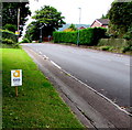
Abergavenny Food Festival 2017 advert, Hereford Road, Mardy
The advert facing northbound traffic shows that Abergavenny Food
Festival 2017 will be held on the weekend of September 16th & 17th.
Image: © Jaggery
Taken: 7 Aug 2017
0.02 miles
2
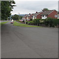
Grassed strip with trees
The narrow strip of grass lies between two roads; the residential St. Francis Close to the left and Hereford Road to the right. Presumably Hereford Road was once the main road north out of Abergavenny; it has now been superseded by a new road to the east avoiding the town.
Image: © Trevor Littlewood
Taken: 15 Oct 2016
0.03 miles
3
Roadside trees, Mardy
Viewed from St Francis Close. Hereford Road is behind the trees.
Image: © Jaggery
Taken: 7 Aug 2017
0.03 miles
4
Croesonen Cottages, Mardy
Semi-detached houses, Hereford Road, Mardy.
Image: © Jaggery
Taken: 1 Sep 2011
0.04 miles
5
St Francis Close, Mardy
Set back from the west side of Hereford Road.
Image: © Jaggery
Taken: 7 Aug 2017
0.04 miles
6
Northern end of St Francis Close, Mardy
St Francis Close is set back from the west side of Hereford Road.
Image: © Jaggery
Taken: 7 Aug 2017
0.05 miles
7
Croesonen Parc, Mardy
Viewed from the edge of Hereford Road looking along one of many arms of Croesonen Parc,
an extensive area of housing on the west bank of the Gavenny River.
Image: © Jaggery
Taken: 7 Aug 2017
0.06 miles
8
Western end of Croesonen Parc, Mardy
Viewed across Hereford Road looking along the road into Croesonen Parc,
an extensive area of housing on the west bank of the Gavenny River.
Image: © Jaggery
Taken: 7 Aug 2017
0.08 miles
9
Traffic visibility mirror, Hereford Road, Mardy
The mirror is opposite a hedge-lined house driveway.
Image: © Jaggery
Taken: 7 Aug 2017
0.08 miles
10
South along St Francis Close, Mardy
Looking towards the St Teilo's Road junction 220 metres from the camera.
Hereford Road is behind the trees and grass on the left.
Image: © Jaggery
Taken: 7 Aug 2017
0.08 miles


