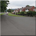
IMAGES TAKEN NEAR TO
Croesonen Parc, ABERGAVENNY, NP7 6PD

Introduction

This page details the photographs taken nearby to Croesonen Parc, NP7 6PD by members of the Geograph project.

The Geograph project started in 2005 with the aim of publishing, organising and preserving representative images for every square kilometre of Great Britain, Ireland and the Isle of Man.

There are currently over 7.5m images from over14,400 individuals and you can help contribute to the project by visiting https://www.geograph.org.uk

Image Map


Images are licensed for reuse under creativecommons.org/licenses/by-sa/2.0
Notes
  • Clicking on the map will re-center to the selected point.
  • The higher the marker number, the further away the image location is from the centre of the postcode.

Image Listing (53 Images Found)

Images are licensed for reuse under creativecommons.org/licenses/by-sa/2.0
  • ...
Image
Details
Distance
1
Rainbow over Mardy
From the Hereford Road.
Image: © Andrew Abbott Taken: 30 Oct 2021
0.05 miles
2
Western end of Croesonen Parc, Mardy
Viewed across Hereford Road looking along the road into Croesonen Parc, an extensive area of housing on the west bank of the Gavenny River.
Image: © Jaggery Taken: 7 Aug 2017
0.05 miles
3
Hereford Road, Abergavenny
Looking towards Croesonen Parc.
Image: © David Howard Taken: 23 Apr 2023
0.06 miles
4
South along St Francis Close, Mardy
Looking towards the St Teilo's Road junction 220 metres from the camera. Hereford Road is behind the trees and grass on the left.
Image: © Jaggery Taken: 7 Aug 2017
0.07 miles
5
Hereford Road, Abergavenny
Looking towards Blorenge hill.
Image: © David Howard Taken: 23 Apr 2023
0.09 miles
6
Ordnance Survey Cut Mark
This OS cut mark can be found on the outbuilding of No72 Hereford Road. It marks a point 90.321m above mean sea level.
Image: © Adrian Dust Taken: 3 Jul 2020
0.09 miles
7
New housing development on the B4521
Image: © Roger Cornfoot Taken: 5 Feb 2023
0.11 miles
8
St Teilo's Road bungalows, Mardy
Viewed across Hereford Road at the southern boundary http://www.geograph.org.uk/photo/2580405 of Mardy.
Image: © Jaggery Taken: 1 Sep 2011
0.11 miles
9
Southern end of St Teilo's Road, Mardy
Viewed from near the corner of Hereford Road.
Image: © Jaggery Taken: 26 Aug 2011
0.11 miles
10
Wyndham Road, Abergavenny
Image: © David Howard Taken: 23 Apr 2023
0.12 miles
  • ...