1
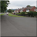
Southern end of St Teilo's Road, Mardy
Viewed from near the corner of Hereford Road.
Image: © Jaggery
Taken: 26 Aug 2011
0.03 miles
2
Lloyds Dairies milk float, St Teilo's Road, Mardy
Once a common sight in many parts of the UK, these battery-powered electric vehicles are now (2011) a rarity. One benefit of a milk float is that is a very quiet vehicle, ideal for use in residential areas during the early hours of the morning when most people are asleep.
Image: © Jaggery
Taken: 1 Sep 2011
0.05 miles
3
Hereford Road, Abergavenny
Looking towards Blorenge hill.
Image: © David Howard
Taken: 23 Apr 2023
0.07 miles
4
St Teilo's Road bungalows, Mardy
Viewed across Hereford Road at the southern boundary http://www.geograph.org.uk/photo/2580405 of Mardy.
Image: © Jaggery
Taken: 1 Sep 2011
0.09 miles
5
Old care home on Lansdown Road, Abergavenny
Initially built in the late Victorian era or Edwardian era as a substantial town house for the very well to do of Abergavenny on what was then, the leafy outskirts above the town.
Later surrounded by 1950's council estates the building became 'an old people's home' as they used to call them, which I assume is now no longer suitable due to changing legislation and commercial pressures, so who knows its future?
Image: © Jeremy Bolwell
Taken: 24 Jun 2012
0.09 miles
6
Rainbow over Mardy
From the Hereford Road.
Image: © Andrew Abbott
Taken: 30 Oct 2021
0.10 miles
7
Hereford Road, Abergavenny
Looking towards Croesonen Parc.
Image: © David Howard
Taken: 23 Apr 2023
0.10 miles
8
Ordnance Survey Cut Mark
This OS cut mark can be found on the outbuilding of No72 Hereford Road. It marks a point 90.321m above mean sea level.
Image: © Adrian Dust
Taken: 3 Jul 2020
0.10 miles
9
South along St Francis Close, Mardy
Looking towards the St Teilo's Road junction 220 metres from the camera.
Hereford Road is behind the trees and grass on the left.
Image: © Jaggery
Taken: 7 Aug 2017
0.11 miles
10
Western end of Croesonen Parc, Mardy
Viewed across Hereford Road looking along the road into Croesonen Parc,
an extensive area of housing on the west bank of the Gavenny River.
Image: © Jaggery
Taken: 7 Aug 2017
0.14 miles


