IMAGES TAKEN NEAR TO
Beaupreau Place, ABERGAVENNY, NP7 5LZ

Introduction

This page details the photographs taken nearby to Beaupreau Place, NP7 5LZ by members of the Geograph project.

The Geograph project started in 2005 with the aim of publishing, organising and preserving representative images for every square kilometre of Great Britain, Ireland and the Isle of Man.

There are currently over 7.5m images from over14,400 individuals and you can help contribute to the project by visiting https://www.geograph.org.uk

Image Map


Images are licensed for reuse under creativecommons.org/licenses/by-sa/2.0
Notes
  • Clicking on the map will re-center to the selected point.
  • The higher the marker number, the further away the image location is from the centre of the postcode.

Image Listing (292 Images Found)

Images are licensed for reuse under creativecommons.org/licenses/by-sa/2.0
  • ...
Image
Details
Distance
1
Gavenny Way, Abergavenny
Viewed from the B4233 Old Monmouth Road. Ahead is the left turn into Ostringen Close. Östringen in Germany is one of Abergavenny's twin towns.
Image: © Jaggery Taken: 17 May 2013
0.03 miles
2
Footbridge over River Gavenny.
A pleasant footbridge linking a new estate to the town of Abergavenny.
Image: © G Bradshaw Taken: 9 Apr 2007
0.04 miles
3
Woodland walk.
This delightful path close to the River Gavenny is popular with walkers.
Image: © G Bradshaw Taken: 27 Apr 2007
0.05 miles
4
Snowbridge.
Snow gives a magical touch to this footbridge over the River Gavenny.
Image: © G Bradshaw Taken: 8 Feb 2007
0.06 miles
5
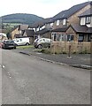
Gavenny Way houses and cars, Abergavenny
Viewed from the B4233 in August 2024.
Image: © Jaggery Taken: 11 Aug 2024
0.06 miles
6
Sycamore Avenue, Abergavenny
Viewed from the Old Monmouth Road end. Formerly a road through Pen-y-Fal Hospital, now a road through an area of housing named Parc Pen-y-Fal.
Image: © Jaggery Taken: 17 May 2013
0.07 miles
7
The former hospital - now flats.
Image: © Ruth Sharville Taken: 28 Jul 2009
0.07 miles
8
The former Pen-y-Fal Chapel, Abergavenny
Image: © Gareth James Taken: 27 Nov 2010
0.07 miles
9
Former Pen y Fal chapel, Abergavenny
Located between Gavenny Way and Sycamore Avenue, on the north side of Old Monmouth Road (B4233). Pen y Fal Hospital opened in 1851 as a lunatic asylum (in the terminology of the period). This chapel replaced one that had previously been used within the main hospital itself. Since the closure of the hospital in 1997, the chapel has been unused.
Image: © Jaggery Taken: 28 Apr 2010
0.08 miles
10
Church opposite the old hospital
The smaller windows of this little Victorian church are boarded up - so I assume it is now redundant.
Image: © Ruth Sharville Taken: 28 Jul 2009
0.08 miles
  • ...