1
Limetree Mews and Limetree Court, Abergavenny
On the south side of Station Road near Abergavenny railway station.
Image: © Jaggery
Taken: 31 Dec 2017
0.01 miles
2
Marsh Court, Abergavenny
Flats on the south side of Station Road near Abergavenny railway station.
Image: © Jaggery
Taken: 31 Dec 2017
0.01 miles
3
Southbound A465, Abergavenny
The A465 here runs parallel with the railway lines south of Abergavenny Station, which is about 40 metres away, on the other side of the hedge on the right.
Image: © Jaggery
Taken: 20 Oct 2010
0.02 miles
4
Former railway buildings near Abergavenny station
The stone buildings, one with two storeys and two smaller ones each with one storey, are in the middle of newer business units in Station Enterprises, a business park on the south side of the railway station. There was no external indication of the current use of the stone buildings. Several notices on the buildings show the same message - PRIVATE NO PARKING.
Image: © Jaggery
Taken: 19 Jun 2011
0.02 miles
5
Pomegranate, Abergavenny
Located at unit 3, Station Enterprises, (the premises with the orange nameboard), Pomegranate's services include graphic design and digital print.
Image: © Jaggery
Taken: 19 Jun 2011
0.02 miles
6
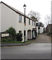
Station Road houses, Abergavenny
On the south side of Station Road on the approach to Abergavenny railway station.
Station Road dates from the 1850s. These houses were built many decades later.
Image: © Jaggery
Taken: 31 Dec 2017
0.02 miles
7
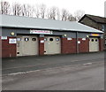
Driving Test Centre, Abergavenny
Driver & Vehicle Standards Agency site on the south side of Station Road.
Image: © Jaggery
Taken: 31 Dec 2017
0.03 miles
8
Station Road towards Abergavenny railway station
From the corner of the A40 Monmouth Road. The station http://www.geograph.org.uk/photo/2652374 is 250 metres ahead.
Image: © Jaggery
Taken: 19 Dec 2014
0.03 miles
9
The Laundry Basket in Abergavenny
Located in Station Enterprises Units 9 and 10 near Abergavenny railway station.
Image: © Jaggery
Taken: 31 Dec 2017
0.03 miles
10
Manual signalbox at Abergavenny
Abergavenny station (formerly known as Abergavenny Monmouth Road to distinguish it from the two other stations serving the town) is still manually signalled with GWR lower quadrant semaphore signals. The train is the 14.01 to Manchester.
Image: © Richard Green
Taken: 30 Mar 2011
0.04 miles


