1
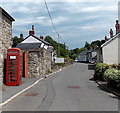
Red phonebox, Maesygwartha
There is a notice, in Welsh only, on the phonebox. I guessed it could mean that the phonebox was out of order. I later translated the words: coins are not accepted.
Image: © Jaggery
Taken: 7 Jun 2013
0.02 miles
2
Wall-mounted postbox, Maesygwartha
The postbox is in a wall alongside Sunnybank House.
Image: © Jaggery
Taken: 7 Jun 2013
0.05 miles
3
Footbridge over the Afon Clydach
Rural spot in a wooded valley, but only 200m or so from the traffic on A465.
Image: © Gordon Hatton
Taken: 19 Sep 2022
0.06 miles
4
Afon Clydach at Pwll y rhys
I'm relying on fellow contributor Alan Bowring for the name of this waterfall as it isn't shown on current OS maps. This shot taken after a dry summer and is worth comparing with Alan's photo from January 2014.
Image: © Gordon Hatton
Taken: 19 Sep 2022
0.07 miles
5
Footbridge over River Clydach at Maesygwartha
Just a few yards away from the Heads of the Valleys road but a surprisingly picturesque and tranquil spot. There is a small waterfall just to the left of the bridge.
Image: © John Brightley
Taken: 22 Oct 2010
0.07 miles
6
River Clydach at Maesygwartha
I was surprised that nobody else had submitted photos of this photogenic spot.
Image: © John Brightley
Taken: 22 Oct 2010
0.07 miles
7
River Clydach at Maesygwartha
Image: © John Brightley
Taken: 22 Oct 2010
0.07 miles
8
Pwll y Rhys
The Afon Clydach in flood conditions roars beneath the footbridge and into Pwll y Rhys. Awesome!
Image: © Alan Bowring
Taken: 3 Jan 2016
0.07 miles
9
Pwll y rhys
Surprisingly this waterfall is not indicated on most maps. The plunge pool excavated into the Old Red Sandstone bedrock is referred to on older maps as Pwll y rhys which, according to a local expert, translates in local dialect as 'pool of entanglement' or 'pool of fear'. There are a number of other falls on the Clydach, un-named on the map. This was a very wet day - don't expect this much water in normal conditions! The footbridge above it permits a good view down the falls.
Image: © Alan Bowring
Taken: 18 Jan 2014
0.07 miles
10
Maesygwartha House, Maesygwartha
Viewed from the public footpath which crosses the driveway on its way to Llanelly.
Image: © John Brightley
Taken: 22 Oct 2010
0.11 miles


