1
Ball's Pond, Blaenavon
Ball's Pond was formerly part of industrial Blaenavon's extensive water management system, which provided water for the ironworks and water-balance systems of local pits.
Elgam Avenue houses are in the distance.
Image: © Jaggery
Taken: 3 Apr 2011
0.04 miles
2
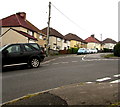
Elgam Avenue, Blaenavon
Ascending from the corner of Rifle Street.
Image: © Jaggery
Taken: 2 Oct 2015
0.05 miles
3
Elgam Avenue bus stops, Blaenavon
Viewed from the corner of Rifle Street.
Image: © Jaggery
Taken: 2 Oct 2015
0.06 miles
4
Rifle Street, Blaenavon
Viewed across Abergavenny Road. The Rifleman's Arms http://www.geograph.org.uk/photo/2809135 is on the right.
Image: © Jaggery
Taken: 2 Oct 2015
0.07 miles
5
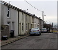
Houses on the north side of Rifle Street, Blaenavon
Viewed from the corner of Abergavenny Road.
Image: © Jaggery
Taken: 2 Oct 2015
0.08 miles
6
Moorland east of Abergavenny Road, Blaenavon
Viewed from near this http://www.geograph.org.uk/photo/2811484 stile at about 415 metres (1,360 feet) above mean sea level.
Image: © Jaggery
Taken: 3 Apr 2011
0.10 miles
7
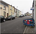
Rifle Street footway closed, Blaenavon
In early October 2015, a small barrier cordons off a hole in the pavement.
Image: © Jaggery
Taken: 2 Oct 2015
0.10 miles
8
Elgam & District Workmens Club, Blaenavon
The club at 5 Rifle Street is affiliated to the C.I.U (Club and Institute Union).
Image: © Jaggery
Taken: 2 Oct 2015
0.11 miles
9
Maxworthy Road houses, Blaenavon
Viewed from the corner of Rifle Street looking along Maxworthy Road towards Phillips Street.
Image: © Jaggery
Taken: 2 Oct 2015
0.11 miles
10
Southeast side of the Rifleman's Arms, Blaenavon
Abergavenny Road side of the pub (with accommodation and a restaurant) on the corner of Rifle Street.
Image: © Jaggery
Taken: 2 Oct 2015
0.13 miles


