1
Ty-gwyn Farm, Pontnewynydd
Farm buildings viewed across the Hospital Road perimeter wall.
Image: © Jaggery
Taken: 9 May 2011
0.02 miles
2
The Afon Lwyd Valley
Image: © Roger Cornfoot
Taken: 11 Apr 2007
0.04 miles
3
Royal Oak, Pontnewynydd
Pub alongside the B4246. Some maps show this location as the southern end of Freeholdland Road
whereas the pub's website states (the northern end of) George Street.
Image: © Jaggery
Taken: 17 Dec 2015
0.06 miles
4
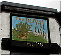
Royal Oak name sign, Pontnewynydd
On a corner of this http://www.geograph.org.uk/photo/4767230 pub. The faded gold lettering at the bottom of the sign formerly showed USHERS.
Image: © Jaggery
Taken: 17 Dec 2015
0.06 miles
5
Bus stop opposite the Royal Oak, Pontnewynydd
On the B4246 opposite this http://www.geograph.org.uk/photo/4767230 pub.
Image: © Jaggery
Taken: 17 Dec 2015
0.06 miles
6
Directions in Pontnewynydd for Pontypool Accident Repair Centre
Facing vehicles travelling southeastwards on the A4043, the notice gives
directions to Pontypool Accident Repair Centre in North Pontypool Industrial Estate.
Image: © Jaggery
Taken: 17 Dec 2015
0.06 miles
7
The Royal Oak, Pontnewynydd
Pub alongside the B4246. Some maps show this location as the southern end of Freeholdland Road whereas the pub's website states (the northern end of) George Street.
Image: © Jaggery
Taken: 25 Oct 2010
0.06 miles
8
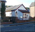
Emmaus Chapel, Pontnewynydd
Located on Freeholdland Road. The chapel is one of 35 chapels or churches in Wales which are affiliated to the Congregational Federation. On the left is Chapel House. http://www.geograph.org.uk/photo/2127916
Image: © Jaggery
Taken: 25 Oct 2010
0.06 miles
9
Chapel House, Pontnewynydd
Located on Freeholdland Road. Emmaus Chapel http://www.geograph.org.uk/photo/2127907 is on the right.
Image: © Jaggery
Taken: 25 Oct 2010
0.06 miles
10
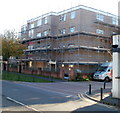
Belle Vue Court, Pontnewynydd
Located on George Street. One of several flats buildings in the area that were encased in scaffolding at the end of October 2010. On the right is the edge of The Royal Oak pub. http://www.geograph.org.uk/photo/2127888
Image: © Jaggery
Taken: 25 Oct 2010
0.06 miles


