1
St Cadocs Road bus stops, Trevethin, Pontypool
Viewed from the corner of Ridgeway.
Yellow letters on the road surface show BUS STOP in English and SAFLE BWS in Welsh.
Image: © Jaggery
Taken: 1 Jun 2011
0.13 miles
2
Welcome to St Cadocs, Trevethin, Pontypool
The welcome, in English and Welsh, is on a wall in Ridgeway on the corner of St Cadocs Road.
Image: © Jaggery
Taken: 1 Jun 2011
0.14 miles
3
Tenison Road houses, Trevethin, Pontypool
Viewed from the SW end of Ridgeway.
Image: © Jaggery
Taken: 1 Jun 2011
0.15 miles
4
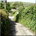
Folly Lane, Trevethin, Pontypool
Folly Road behind the camera has become Folly Lane
as the road heads NE away from residential Trevethin.
Image: © Jaggery
Taken: 7 Jun 2011
0.16 miles
5
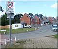
St Cadoc's Road, Pontypool
Houses on the west side of the road viewed from near the St Cadocs boundary sign. http://www.geograph.org.uk/photo/2430843
There is a colourful Welcome mosaic http://www.geograph.org.uk/photo/2430861 on the white wall ahead.
Image: © Jaggery
Taken: 27 May 2011
0.19 miles
6
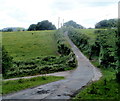
Folly Lane climbs towards Trevethin, Pontypool
The left turn is a farm access lane. http://www.geograph.org.uk/photo/3415651
Image: © Jaggery
Taken: 7 Jun 2011
0.20 miles
7
Access lane to Nant-y-gollen Farm east of Trevethin, Pontypool
The farm access lane heads away from Folly Lane.
Image: © Jaggery
Taken: 7 Jun 2011
0.21 miles
8
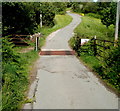
Folly Lane cattle grid near a stream east of Trevethin, Pontypool
A few metres beyond the cattle grid, Folly Lane crosses over a stream, Nant-y-Gollen.
One of the bridge's stone walls can be seen on the left side of the road.
Image: © Jaggery
Taken: 7 Jun 2011
0.21 miles
9
Trevethin Youth Centre, Pontypool
Located at the eastern edge of Ysgol Gyfun Gwynllyw. http://www.geograph.org.uk/photo/3415419
Image: © Jaggery
Taken: 1 Jun 2011
0.23 miles
10
Folly Lane passes the Nant-y-gollen Farm turning east of Trevethin, Pontypool
The right turn is a farm access lane. http://www.geograph.org.uk/photo/3415651
The yellow box on the side of the road ahead contains grit for treating the road surface in icy or snowy weather. This location is 240 metres (nearly 800 ft) above mean sea level.
Image: © Jaggery
Taken: 7 Jun 2011
0.23 miles


