1
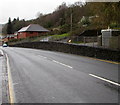
Freeholdland Road houses, Pontnewynydd
A detached house and a short row of houses are on the eastern side of Freeholdland Road, viewed from near the point where the road (the B4246) is renamed Limekiln Road, behind the camera.
Image: © Jaggery
Taken: 9 May 2011
0.03 miles
2
Narrow Lower Leigh Road, Pontnewynydd
Walkers need to proceed carefully ahead - there are no pavements and the road is narrow.
Image: © Jaggery
Taken: 9 May 2011
0.03 miles
3
Log bench at Freeholdland Road bus stop, Pontnewynydd
There is no shelter at this bus stop at the northern edge of Freeholdland Road (B4246). Instead, there is a low bench carved out of a tree trunk.
Image: © Jaggery
Taken: 9 May 2011
0.03 miles
4
Pontnewynydd Primary School
This side (north) of the school is reached via a long, steep and winding footpath from Lower Leigh Road. Vehicular access is on the southern side. http://www.geograph.org.uk/photo/2412227
Construction of the school began in 1901. It opened in 1903. There are currently about 140 pupils enrolled, aged from 4 to 11.
Image: © Jaggery
Taken: 9 May 2011
0.03 miles
5
Snatchwood bus stop and shelter opposite Primrose Lane, Abersychan
This stop alongside the A4043 Snatchwood Road is for northbound buses,
towards the centre of Abersychan, and beyond to Blaenavon via Talywain and Varteg.
Image: © Jaggery
Taken: 17 Dec 2015
0.04 miles
6
Elevated pavement above Snatchwood Road, Abersychan
For 75 metres, the pavement on the west side of the A4043 Snatchwood Road is above road level.
Image: © Jaggery
Taken: 17 Dec 2015
0.05 miles
7
Snatchwood Road signs on the approach to Primrose Lane, Abersychan
No left turn into Primrose Lane.
Image: © Jaggery
Taken: 17 Dec 2015
0.05 miles
8
Welcome to Abersychan
In Torfaen county borough, the A4043 Snatchwood Road from Pontnewynydd passes the southern boundary of Abersychan.
Image: © Jaggery
Taken: 17 Dec 2015
0.05 miles
9
Royal Mail van, Snatchwood Court, Pontnewynydd
Viewed across the A4043 Snatchwood Road.
Snatchwood Court is in the north of Pontnewynydd, near the Abersychan boundary sign. http://www.geograph.org.uk/photo/4770093
Image: © Jaggery
Taken: 17 Dec 2015
0.06 miles
10
Footbridge across the Afon Lwyd, Pontnewynydd
The width of the bridge suggests this route was formerly open for vehicles, but now only pedestrians or cyclists can pass through the metal barriers. The route leads from the B4246 (opposite the Lower Leigh Road junction) to the A4043.
Image: © Jaggery
Taken: 9 May 2011
0.06 miles


