1
St Francis Close, Talywain
This part of St Francis Close (Clos Sant Ffransis in Welsh) is on the corner of the B4246 Church Road, viewed in late September 2015. These houses were built in the second decade of the 21st century. A June 2011 Google Earth Street View shows a building site here with rubble and building materials, but no houses.
Image: © Jaggery
Taken: 29 Sep 2015
0.02 miles
2
Up Church Road, Talywain
The B4246 Church Road is part of a long ascent from Abersychan to Blaenavon.
Image: © Jaggery
Taken: 29 Sep 2015
0.02 miles
3
Church Road houses, Talywain
On the east side of the B4246 Church Road.
Image: © Jaggery
Taken: 29 Sep 2015
0.03 miles
4
Talywain Senior Citizens Hall
Viewed across the B4246 Church Road in late September 2015.
The notice on the left shows Meetings on Thursdays at 2.30pm. Bingo every Friday evening at 7pm.
Image: © Jaggery
Taken: 29 Sep 2015
0.03 miles
5
The Dagmar, Talywain
Pub at 70 Commercial Road. Extensive internal renovation work was in progress at the date of this view, mid-April 2011. Scaffolding can be seen on the left.
Image: © Jaggery
Taken: 13 Apr 2011
0.04 miles
6
The Cons, Talywain
The Cons (its familiar local name) or The British Constitution Inn, is located on the corner of Commercial Road and Church Road. At least 110 years old, probably much older.
UPDATE
A correspondent informed me in late April 2015 that "This pub was recently totally demolished, planning applications for a number of houses is being sought for the site."
http://www.geograph.org.uk/photo/4680529 to construction work in progress in late September 2015.
Image: © Jaggery
Taken: 12 May 2010
0.05 miles
7
St Francis Close, Talywain
St Francis Close (Clos Sant Ffransis in Welsh) is a cul-de-sac on the west side of the B4246 Church Road, viewed in late September 2015. These houses were built in the second decade of the 21st century. A June 2011 Google Earth Street View shows a building site here with rubble and building materials, but no houses.
Image: © Jaggery
Taken: 29 Sep 2015
0.05 miles
8
North side of Cwrt y Porth Fawr, Talywain
Part of an area of modern houses on the west side of the B4246 Church Road.
Image: © Jaggery
Taken: 29 Sep 2015
0.05 miles
9
Heol Waun field gates, Talywain
The gates on the corner of Heol Waun and Church Road gives access to a field
on the north side of houses in St Francis Close, http://www.geograph.org.uk/photo/4681361 built in 2011-2012.
Image: © Jaggery
Taken: 29 Sep 2015
0.05 miles
10
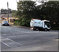
Scarab at work in Talywain
The Torfaen Borough Council Scarab vehicle is cleaning the corner of Church Road and Manor Road.
Image: © Jaggery
Taken: 29 Sep 2015
0.06 miles


