1
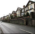
White house above St Luke's Road, Pontnewynydd
In an area of houses set above road level on this side of the A4043.
Image: © Jaggery
Taken: 17 Dec 2015
0.02 miles
2
Torfaen Terrace, Pontnewynydd
On Freeholdland Road immediately south of the Afon Lwyd river bridge, this long row of houses is named Torfaen Terrace. The houses are numbered separately from other Freeholdland Road houses.
Image: © Jaggery
Taken: 9 May 2011
0.04 miles
3
St Luke's Road walls, Pontnewynydd
The houses on the right are set above road level.
The wall on the left is above a path using the route of a dismantled railway.
Image: © Jaggery
Taken: 17 Dec 2015
0.04 miles
4
Llwyd Court, Pontnewynydd
Cul-de-sac viewed across the A4043. This junction is where the A4043 Snatchwood Road to the right
(towards Abersychan) becomes the A4043 St Luke's Road to the left (towards the centre of Pontypool).
Image: © Jaggery
Taken: 17 Dec 2015
0.05 miles
5
Groveside Villas, Pontnewynydd
Houses above the A4043 St Lukes Road.
Image: © Jaggery
Taken: 17 Dec 2015
0.06 miles
6
Former railway route, Pontnewynydd
The path uses a flattish former railway route on land between the A4043 on the left and a river, the Afon Lwyd, 150 metres to the right. The next station ahead was Snatchwood Halt, where passenger services ended in 1953.
Image: © Jaggery
Taken: 17 Dec 2015
0.06 miles
7
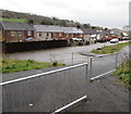
Towards Machine Meadow houses, Pontnewynydd
From the edge of the A4043 St Luke's Road.
Image: © Jaggery
Taken: 17 Dec 2015
0.06 miles
8
Southeast end of Groveside Villas, Pontnewynydd
Houses above the A4043 St Lukes Road.
Image: © Jaggery
Taken: 17 Dec 2015
0.08 miles
9
Reroofing in progress, River Row, Pontnewynydd
Scaffolding covers the 60 metre length of River Row during work on the roofs. River Row is on the west bank of the Afon Lwyd.
Image: © Jaggery
Taken: 9 May 2011
0.09 miles
10
Afon Llwyd Terrace, Pontnewynydd
Houses on the southern half of Afon Llwyd Terrace.
Strangely, in English both Afon Lwyd and Afon Llwyd are used for the name of the nearby river, but the correct Welsh form is Afon Lwyd (Grey River).
Image: © Jaggery
Taken: 9 May 2011
0.09 miles


