1
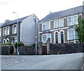
Penywain Terrace, Pontypool
Houses on the south side of the street, viewed from the corner of Penywain Road.
Image: © Jaggery
Taken: 16 May 2011
0.04 miles
2
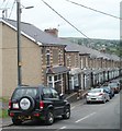
Wainfelin Road, Pontypool
Houses at the western end of Wainfelin Road viewed from top (SE) end of Merchant's Hill.
Image: © Jaggery
Taken: 10 May 2011
0.05 miles
3
Looking east along Fowler Street, Wainfelin, Pontypool
The view from an open space at the western end of the street, which runs due east for 175 metres to the junction of Merchant's Hill, Wainfelin Road and Penywain Road. Just out of shot beyond the lower left corner of the view, Fowler Street meets the southern end of Elled Road.
Image: © Jaggery
Taken: 10 May 2011
0.05 miles
4
Pontypool from the air
Pontnewynydd is to the right in this view from a Bristol bound flight from Glasgow. The A472 road is to the left.
Image: © Thomas Nugent
Taken: 2 Apr 2012
0.05 miles
5
Fowler Street, Wainfelin, Pontypool
Houses on the north side of the street viewed from the western end of Wainfelin Road.
Image: © Jaggery
Taken: 10 May 2011
0.05 miles
6
Ordnance Survey Cut Mark
This OS cut mark can be found on No55 Fowler Street. It marks a point 162.175m above mean sea level.
Image: © Adrian Dust
Taken: 7 Jul 2019
0.07 miles
7
Ordnance Survey Cut Mark
This OS cut mark can be found on the wall of No3 Wainfelin Road. It marks a point 157.265m above mean sea level.
Image: © Adrian Dust
Taken: 7 Jul 2019
0.09 miles
8
Ordnance Survey Cut Mark
This OS cut mark can be found on No60 Wainfelin Avenue. It marks a point 177.132m above mean sea level.
Image: © Adrian Dust
Taken: 7 Jul 2019
0.09 miles
9
Wainfelin Avenue, Pontypool
Houses on the north side of the street, viewed from the corner of Penywain Road.
Image: © Jaggery
Taken: 16 May 2011
0.09 miles
10
National Cycle Route 492, Elled Road, Pontnewynydd
Junction of cycle route, on former railway track bed, and Elled Road.
Image: © M J Roscoe
Taken: 6 Dec 2016
0.10 miles


