1
Ordnance Survey Cut Mark
This OS cut mark can be found on the wall of No3 Wainfelin Road. It marks a point 157.265m above mean sea level.
Image: © Adrian Dust
Taken: 7 Jul 2019
0.03 miles
2
Former railway bridge, Merchant's Hill, Pontnewynydd
Without a knowledge of the history of the area, the presence of a bridge here would be a mystery. Formerly, it carried the Merchant's Hill roadway over a railway line. Pontnewynydd Station (closed in 1962) was nearby.
Image: © Jaggery
Taken: 10 May 2011
0.04 miles
3
No pavements across bridge, Merchant's Hill, Pontypool
Viewed from near the corner of Elled Road. Pedestrians need to be wary when crossing this bridge. http://www.geograph.org.uk/photo/2425363
Image: © Jaggery
Taken: 10 May 2011
0.04 miles
4
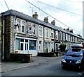
Wainfelin Road, Pontypool
Viewed from the Merchants Hill end looking ESE.
On the left at 1 Wainfelin Road is a fish & chips shop and off licence.
Image: © Jaggery
Taken: 23 Sep 2011
0.05 miles
5
A4043 heads NW away from Pontypool
Viewed from the edge of Riverside Roundabout. http://www.geograph.org.uk/photo/2395265 The A4043 heads for Blaenavon, via Abersychan and Cwmavon.
Image: © Jaggery
Taken: 4 May 2011
0.05 miles
6
NCN492 south of Pontnewynydd
The cycle route follows the old railway through a shallow cutting
Image: © David Smith
Taken: 26 Sep 2021
0.06 miles
7
Army Cadet site, Osborne Road, Pontypool
The building is inside a compound protected by a metal fence topped with barbed wire.
A notice on the fence shows M.O.D. PROPERTY KEEP OUT.
M.O.D = Ministry of Defence.
Image: © Jaggery
Taken: 2 Jan 2014
0.06 miles
8
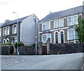
Wainfelin Road, Pontypool
Houses at the western end of Wainfelin Road viewed from top (SE) end of Merchant's Hill.
Image: © Jaggery
Taken: 10 May 2011
0.06 miles
9
Looking east along Fowler Street, Wainfelin, Pontypool
The view from an open space at the western end of the street, which runs due east for 175 metres to the junction of Merchant's Hill, Wainfelin Road and Penywain Road. Just out of shot beyond the lower left corner of the view, Fowler Street meets the southern end of Elled Road.
Image: © Jaggery
Taken: 10 May 2011
0.06 miles
10
Pontypool from the air
Pontnewynydd is to the right in this view from a Bristol bound flight from Glasgow. The A472 road is to the left.
Image: © Thomas Nugent
Taken: 2 Apr 2012
0.06 miles


