IMAGES TAKEN NEAR TO
Penyrheol, PONTYPOOL, NP4 5XY
Introduction
This page details the photographs taken nearby to NP4 5XY by members of the Geograph project.
The Geograph project started in 2005 with the aim of publishing, organising and preserving representative images for every square kilometre of Great Britain, Ireland and the Isle of Man.

There are currently over 7.5m images from over14,400 individuals and you can help contribute to the project by visiting https://www.geograph.org.uk
Image Map
Images are licensed for reuse under creativecommons.org/licenses/by-sa/2.0
Notes
- Clicking on the map will re-center to the selected point.
- The higher the marker number, the further away the image location is from the centre of the postcode.
Image Listing (24 Images Found)
Images are licensed for reuse under creativecommons.org/licenses/by-sa/2.0
Image
Details
Distance
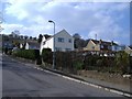
1
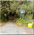
Eastern end of Cwrdy Lane, Griffithstown, Pontypool
Residential Cwrdy Road behind the camera narrows to Cwrdy Lane. Ahead is a steep climb to Penyrheol.
Image: © Jaggery
Taken: 8 Oct 2011
0.12 miles
2
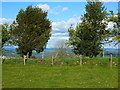
View east from the road near Hill Farm, Penyrheol
Image: © Ruth Sharville
Taken: 11 May 2012
0.13 miles
3
Western end of Cwrdy Lane south of Penyrheol
Cwrdy Lane heads east away from Mountain Road towards Cwrdy Road and the Griffithstown area of Pontypool. Blue signs show that Cwrdy Lane is a single track road with no passing places (because of the steep-sided edges of the lane). If two vehicles meet ahead, which one has to reverse?
Image: © Jaggery
Taken: 8 Oct 2011
0.13 miles
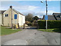
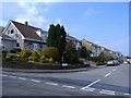
4
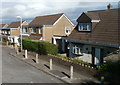
Mountain Road houses, Penyrheol
Houses on the east side of Mountain Road, north of the Cwrdy Road junction.
Image: © Jaggery
Taken: 26 Oct 2011
0.13 miles
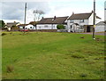
5
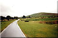
Mountain Road
Heol y Mynydd yn arwain i gyfeiriad Mynydd Twyn Glas yn y pellter.
Mountain Road heading in the direction of Mynydd Twyn Glas (trans. green hillock mountain) in the distance.
Image: © Alan Richards
Taken: 28 Jul 1998
0.14 miles
7
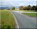
Mountain Road approaches Penyrheol from the south
Viewed from near the Cwrdy Lane junction. http://www.geograph.org.uk/photo/3240157
Image: © Jaggery
Taken: 8 Oct 2011
0.16 miles
9
Southern end of St Anthony's Close, Griffithstown, Pontypool
Viewed from the Cwrdy Road end, from where there is no vehicular access to St Anthony's Close. Vehicles enter the close from St Augustine Road at its northern end.
Image: © Jaggery
Taken: 8 Oct 2011
0.17 miles
10
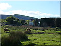
Cattle on the common, Hill Farm, Penyrheol
Image: © Ruth Sharville
Taken: 11 May 2012
0.19 miles