1
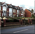
Glengariff Court, Griffithstown, Pontypool
Viewed from Greenhill Road.
Image: © Jaggery
Taken: 21 Oct 2009
0.03 miles
2
Greenhill Road houses, Griffithstown, Pontypool
On the west side of Greenhill Road, between The Avenue to the south and Glengariff Court to the north.
Image: © Jaggery
Taken: 24 Jan 2015
0.05 miles
3
Greenhill Road houses, Griffithstown, Pontypool
Houses at the northern end of Greenhill Road, on the corner of Kemys Street. Just out of shot on the opposite corner (of Kemys Street and Sunnybank Road) is St Hilda's church. http://www.geograph.org.uk/photo/1577404
Image: © Jaggery
Taken: 21 Jan 2011
0.05 miles
4
Greenhill Road postbox, Griffithstown, Pontypool
The Glengariff Court junction http://www.geograph.org.uk/photo/1577335 is on the right.
Image: © Jaggery
Taken: 24 Jan 2015
0.06 miles
5
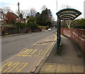
Queensbury bus shelter, Greenhill Road, Pontypool
I expected to see a timetable on this shelter. There wasn't one. Instead there was a Queensbury Shelters Ltd notice which quotes good things said about the company by Mendip District Council, Peel Advertising, Swale Borough Council, Hampshire County Council and the Stratton Association of Parish Councils.
All very interesting, but I'd rather have seen a bus timetable here...
Image: © Jaggery
Taken: 27 Jan 2015
0.07 miles
6
Sebastopol and Griffithstown boundary signs, Pontypool
On the island at the junction of Greenhill Road and The Avenue.
The sign on the left shows Griffithstown, Sebastopol on the right.
Image: © Jaggery
Taken: 24 Jan 2015
0.07 miles
7
St John Ambulance hall, Griffithstown, Pontypool
Located in Greenway Drive near the Cwrdy Road junction.
Image: © Jaggery
Taken: 8 Oct 2011
0.07 miles
8
Entrance to Panteg House sports & social club, Griffithstown, Pontypool
From Greenhill Road.
Image: © Jaggery
Taken: 24 Jan 2015
0.07 miles
9
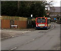
X24 bus in Griffithstown, Pontypool
On the X24 route from Newport to Blaenavon, the Stagecoach bus
is at the bus stop on the corner of Greenhill Road and Glengariff Court.
Image: © Jaggery
Taken: 27 Jan 2015
0.08 miles
10
Sebastopol / Griffithstown boundary
The sign next to the lamppost on the grassy island announces the start of Griffithstown (and thus the end of Sebastopol). The view is of Greenhill Road. Cwrdy Road and The Avenue join from the left.
Image: © Jaggery
Taken: 21 Oct 2009
0.08 miles


