IMAGES TAKEN NEAR TO
Tramway Close, CWMBRAN, NP44 6UT
Introduction
This page details the photographs taken nearby to Tramway Close, NP44 6UT by members of the Geograph project.
The Geograph project started in 2005 with the aim of publishing, organising and preserving representative images for every square kilometre of Great Britain, Ireland and the Isle of Man.

There are currently over 7.5m images from over14,400 individuals and you can help contribute to the project by visiting https://www.geograph.org.uk
Image Map
Images are licensed for reuse under creativecommons.org/licenses/by-sa/2.0
Notes
- Clicking on the map will re-center to the selected point.
- The higher the marker number, the further away the image location is from the centre of the postcode.
Image Listing (43 Images Found)
Images are licensed for reuse under creativecommons.org/licenses/by-sa/2.0
Image
Details
Distance

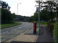
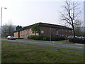
2
Ty Canol Court, Cwmbran
31 1-bedroom sheltered housing flats on the corner of Henllys Way and Ty Canol Row.
Image: © Jaggery
Taken: 8 Apr 2010
0.05 miles
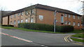
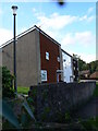
3
Orchid Court, Ty Canol, Cwmbran
Viewed from Henllys Way.
Image: © Jaggery
Taken: 8 Apr 2010
0.05 miles
4
Tolpath, Coed Eva, Cwmbran
Viewed from Henllys Way.
Image: © Jaggery
Taken: 8 Apr 2010
0.05 miles
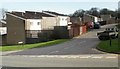
5
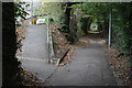
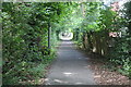
The Incline, Tramway Close, Cwmbran
The incline, now a cycle lane and footpath, follows the route of the dismantled tramway from the former Henllys Colliery down towards the canal in Cwmbran. The path up to the left leads into Tramway Close.
Image: © M J Roscoe
Taken: 8 Nov 2016
0.06 miles
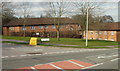
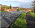
6
Housing in Cwmbran
Quite a distinct shape in this part of Cwmbran
Image: © Colin Madge
Taken: 12 Aug 2008
0.06 miles
8
Henllys Way east of Ty Canol Way, Cwmbran
Henllys Way descends eastwards away from the junction with Ty Canol Way. http://www.geograph.org.uk/photo/2758000
Image: © Jaggery
Taken: 7 Jan 2012
0.07 miles
9
The Incline, by Coed Meyrick-moel, Cwmbran
Looking up a cycle and footpath alongside Coed Meyric-moel local nature reserve (left) Image The incline is on the route of an old tramway from Henllys Colliery down to the Monmouthshire & Brecon Canal.
Image: © M J Roscoe
Taken: 25 Jul 2017
0.07 miles