1
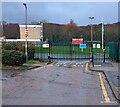
Underpass, Henllys Way, Coed Eva
A pedestrian underpass beneath Henllys Way, viewed from the east side. Nearby on the other side of the underpass is Rede Road.
Image: © Jaggery
Taken: 8 Apr 2010
0.06 miles
2
Deciduous trees in winter, Coed Eva, Cwmbran
Leafless trees viewed from Henllys Way on December 31st 2023.
Image: © Jaggery
Taken: 31 Dec 2023
0.06 miles
3
COURT B Teynes 4-16 name sign on grass, Coed Eva, Cwmbran
Alongside the road named Teynes. The entrance https://www.geograph.org.uk/photo/7680347 to Coed Eva Primary School is behind the camera.
Image: © Jaggery
Taken: 31 Dec 2023
0.07 miles
4
Yellow on green, Teynes, Coed Eva, Cwmbran
The yellow box containing grit is alongside the road named Teynes.
The entrance https://www.geograph.org.uk/photo/7680347 to Coed Eva Primary School is behind the camera.
Image: © Jaggery
Taken: 31 Dec 2023
0.07 miles
5
Path east from Henllys Way, Coed Eva, Cwmbran
A path heads away from Henllys Way, between the perimeter of Hollybush Primary School and a small wood.
Image: © Jaggery
Taken: 8 Apr 2010
0.09 miles
6
Jule Road, Cwmbran
Viewed from Henllys Way.
Image: © Jaggery
Taken: 8 Apr 2010
0.10 miles
7
Coed Eva Schools sign, Cwmbran
The sign facing Henllys Way is at the eastern end of the road
named Teynes which leads to Coed Eva Primary School. https://www.geograph.org.uk/photo/7680347
Image: © Jaggery
Taken: 31 Dec 2023
0.10 miles
8
TEYNES LEADING TO LADYBENCH, Coed Eva, Cwmbran
The sign facing Henllys Way shows two of several unusual street names in Coed Eva.
It also shows that LEADING TO is YN ARWAIN I in Welsh.
Image: © Jaggery
Taken: 31 Dec 2023
0.11 miles
9
School entrance gates, Coed Eva, Cwmbran
This entrance to Coed Eva Primary School is at the western end of the road named Teynes.
Image: © Jaggery
Taken: 31 Dec 2023
0.11 miles
10
Housing on the west side on Henllys Way, Cwmbran
Viewed from the corner of Ton Road. Jule Road http://www.geograph.org.uk/photo/1794592 is in the background on the far left.
Image: © Jaggery
Taken: 24 Mar 2018
0.12 miles


