1
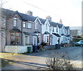
Hodges Terrace, St Dials Road, Cwmbran
A row of six houses on the south side of St Dials Road http://www.geograph.org.uk/photo/2290556 roughly midway between St Dials and Old Cwmbran.
Image: © Jaggery
Taken: 30 Jan 2011
0.01 miles
2
Sheep, St Dials Road, Cwmbran
Sheep grazing in a field opposite Hodges Terrace. http://www.geograph.org.uk/photo/2290976
In the distance, on lower ground, is central Cwmbran. The tall building on the right is the 22-storey The Tower Block. http://www.geograph.org.uk/photo/1611824
Image: © Jaggery
Taken: 30 Jan 2011
0.01 miles
3
Blocked-off St Dials Road, Cwmbran
Near the SE end of St Dials Road, about 350 NW of houses in Old Cwmbran, concrete posts block the roadway.
Image: © Jaggery
Taken: 30 Jan 2011
0.08 miles
4
Cwmbran : Greenforge Way approaches Springvale roundabout
Ahead, at an elongated roundabout, is the entrance road to Springvale Industrial Estate.
Image: © Jaggery
Taken: 30 Jan 2011
0.13 miles
5
Passing place, St Dials Road, Cwmbran
For much of its route, St Dials Road is single-track. This passing place is to the east of Uplands Terrace. http://www.geograph.org.uk/photo/2290627
Image: © Jaggery
Taken: 30 Jan 2011
0.13 miles
6
Currys, Cwmbran Retail Park
Owned by Dixons Retail plc, Currys is a retailer with many High Street stores and retail park superstores in the UK and Ireland. It specialises in selling home electronics items and household appliances.
Image: © Jaggery
Taken: 20 Jul 2011
0.14 miles
7
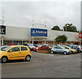
Brantano, Cwmbran Retail Park
Brantano is a European chain of retail stores specialising in footwear.
The Brantano logo depicts a person presumably jumping for joy wearing red shoes bought from Brantano. Another interpretation could be that the person is jumping in pain because of ill-fitting shoes, but that is no doubt a misinterpretation unique to me...
Image: © Jaggery
Taken: 20 Jul 2011
0.14 miles
8
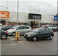
Next, Cwmbran Retail Park
With its HQ in Enderby, Leicestershire, Next is a British retailer selling clothing, footwear, accessories and home products. There are more than 550 stores in the UK and the Republic of Ireland.
Image: © Jaggery
Taken: 20 Jul 2011
0.14 miles
9
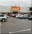
Comet, Cwmbran Retail Park
Comet is an electrical retailer with about 250 stores in the United Kingdom. Comet traces its origins back to 1933, when George Hollingbery opened Comet Battery Stores in Hull.
Image: © Jaggery
Taken: 20 Jul 2011
0.14 miles
10
Victory Outreach UK Church, Cwmbran
Church located in a converted industrial unit on Greenforge Way, between Cwmbran Retail Park and Springvale Industrial Estate. There are about 600 Victory Outreach churches and centres worldwide.
Image: © Jaggery
Taken: 30 Jan 2011
0.14 miles


