1
Entrance gates at the western edge of Welsh Water's Sluvad site
Viewed from Sluvad Road. The notice on the locked gates states:
"All chemical deliveries contact authorised site personnel before unloading/connecting" and
"All contractors must have written authorisation to work on this site. Contact Control staff before commencing work and comply with site safety regulations".
Image: © Jaggery
Taken: 6 Feb 2012
0.13 miles
2
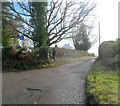
Road to Llandegfedd Reservoir
Heading towards the SW corner of Llandegfedd Reservoir, Sluvad Road climbs away from the junction with the lane http://www.geograph.org.uk/photo/2796620 to Sluvad End Farm.
Image: © Jaggery
Taken: 6 Feb 2012
0.14 miles
3
Works access gate 1, Welsh Water, Sluvad
Viewed from Sluvad Road. The Welsh Water site is located near the western edge of Llandegfedd Reservoir.
Image: © Jaggery
Taken: 6 Feb 2012
0.15 miles
4
Track into woods near Llandegfedd Reservoir
On the right, a narrow track climbs away from the road from Sluvad to Llandegfedd Reservoir.
Traces of recent snow remain on the part of the track nearest the roadway.
Image: © Jaggery
Taken: 6 Feb 2012
0.15 miles
5
Sluvad Road farm buildings
The buildings on the south side of Sluvad Road are located between The Sluvad Farm's farmhouse http://www.geograph.org.uk/photo/2796510 and The Old Dairy.
Image: © Jaggery
Taken: 6 Feb 2012
0.17 miles
6
Lane to Sluvad End Farm
The lane, heading SSE away from Sluvad Road, ends about a kilometre away, at Sluvad End Farm.
Image: © Jaggery
Taken: 6 Feb 2012
0.17 miles
7
A glimpse of Llandegfedd Reservoir from Sluvad Road
For those travelling east along Sluvad Road from Jerusalem Lane, New Inn, the bend in the road ahead gives the first view of the reservoir in the valley below.
Image: © Jaggery
Taken: 6 Feb 2012
0.18 miles
8
Orbitawood, Sluvad Road near Llandegfedd Reservoir
House located alongside a sharp bend in Sluvad Road, to the east of the water treatment works. http://www.geograph.org.uk/photo/2796783
Image: © Jaggery
Taken: 6 Feb 2012
0.18 miles
9
Danger! Fish with care on the banks of Llandegfedd Reservoir
The warning sign on an entrance gate to a reservoir fishing area reminds anglers of the need to look up and look out for overhead electricity power lines. Rods and poles should always be carried at a low level and parallel to the ground.
Image: © Jaggery
Taken: 6 Feb 2012
0.18 miles
10
Exit from Welsh Water site, Sluvad
One can deduce from the two differently-coloured No Entry signs that this is an exit from Welsh Water's water treatment works at Sluvad. Viewed from Sluvad Road, near the western edge of Llandegfedd Reservoir.
Image: © Jaggery
Taken: 6 Feb 2012
0.20 miles


