1
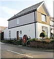
Houses alongside The Highway, New Inn
The houses are between two Ruth Road junctions, one of which is on the left. https://www.geograph.org.uk/photo/5735583
Image: © Jaggery
Taken: 11 Apr 2018
0.04 miles
2
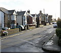
Up Ruth Road, New Inn
Ruth Road ascends from The Highway. This is one of two junctions of these roads.
The other one https://www.geograph.org.uk/photo/5735583 is 180 metres to northwest.
Image: © Jaggery
Taken: 11 Apr 2018
0.06 miles
3
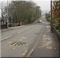
Northwestwards along The Highway, New Inn
The yellow car has just left Ruth Road. A speed camera sign is on the lamppost on the left.
Image: © Jaggery
Taken: 11 Apr 2018
0.06 miles
4
Postbox on the corner of Ruth Road and The Highway, New Inn
The George V postbox is enclosed in an elegant brickwork arch.
Image: © Jaggery
Taken: 17 Jan 2010
0.06 miles
5
Ruth Road, New Inn
Houses on the east side of Ruth Road.
Image: © Jaggery
Taken: 17 Jan 2010
0.06 miles
6
Corner of Ruth Road and The Highway, New Inn
Viewed across The Highway. This is one of two junctions of these roads.
The other one https://www.geograph.org.uk/photo/5735583 is 180 metres to northwest.
Image: © Jaggery
Taken: 11 Apr 2018
0.07 miles
7
King George V postbox, Ruth Road, New Inn
Located on the right here https://www.geograph.org.uk/photo/5735583 near the corner of The Highway.
The GR on the box is short for Georgius Rex, Latin for King George,
in this case King George V who reigned from May 1910-January 1936
Image: © Jaggery
Taken: 11 Apr 2018
0.07 miles
8
The view along the platforms, Pontypool & New Inn station
Platforms 1 (on the right, northbound) and 2 (southbound) at Pontypool & New Inn station are over 100 metres long. This contrasts with the short length of most of the services which now stop here, usually 2 carriages long, occasionally 4.
The station was formerly known as Pontypool Road. For more than a century, from the mid 19th century to the 1960s, Pontypool Road was a railway junction which connected the line from Newport and Cardiff to the Midlands and North of England with the line from Neath and Merthyr.
Pontypool Road station was part of a rail complex, with a 50-track marshalling yard for assembling coal trains destined for all parts of the UK. In addition there were goods sheds, engine sheds and refuelling facilities for the many steam locomotives used on the rail network. Today all that remains is the main line. At one time much of the land in the valley bottom now occupied by the A4042 and the McDonald's roundabout between New Inn and Griffithstown was a sprawling network of railway tracks, sidings and buildings.
Image: © Jaggery
Taken: 17 Jan 2010
0.08 miles
9
Entrance to Pontypool & New Inn railway station
The entrance is reached via a 200-metre long access road from The Highway. The station was originally named Pontypool Road. The addition of 'Road' to a station name was often used when, as here, the station is situated some distance from the centre of the town served. Little now remains of the station as built in 1852.
In 1972 it was renamed Pontypool. The station underwent major refurbishment in 1994, including demolition of buildings no longer required, and '& New Inn' was added to the station name to acknowledge its location.
Under the Arriva Trains Wales 'Adopt a Station' scheme, http://www.geograph.org.uk/photo/1691278 this unmanned station was adopted by Matthew Harrison on February 21st 2006.
Image: © Jaggery
Taken: 17 Jan 2010
0.08 miles
10
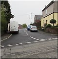
Junction of Ruth Road and The Highway, New Inn
The cars are in Ruth Road. This is one of two junctions of these roads.
The other one is https://www.geograph.org.uk/photo/5735607 180 metres to the southeast.
Image: © Jaggery
Taken: 11 Apr 2018
0.08 miles


