The view along the platforms, Pontypool & New Inn station
Introduction
The photograph on this page of The view along the platforms, Pontypool & New Inn station by Jaggery as part of the Geograph project.
The Geograph project started in 2005 with the aim of publishing, organising and preserving representative images for every square kilometre of Great Britain, Ireland and the Isle of Man.

There are currently over 7.5m images from over 14,400 individuals and you can help contribute to the project by visiting https://www.geograph.org.uk
The view along the platforms, Pontypool & New Inn station
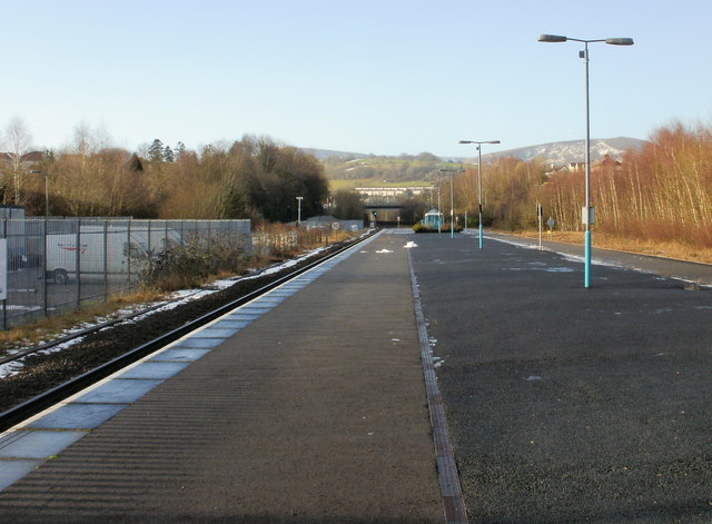
Image: © Jaggery Taken: 17 Jan 2010
Platforms 1 (on the right, northbound) and 2 (southbound) at Pontypool & New Inn station are over 100 metres long. This contrasts with the short length of most of the services which now stop here, usually 2 carriages long, occasionally 4. The station was formerly known as Pontypool Road. For more than a century, from the mid 19th century to the 1960s, Pontypool Road was a railway junction which connected the line from Newport and Cardiff to the Midlands and North of England with the line from Neath and Merthyr. Pontypool Road station was part of a rail complex, with a 50-track marshalling yard for assembling coal trains destined for all parts of the UK. In addition there were goods sheds, engine sheds and refuelling facilities for the many steam locomotives used on the rail network. Today all that remains is the main line. At one time much of the land in the valley bottom now occupied by the A4042 and the McDonald's roundabout between New Inn and Griffithstown was a sprawling network of railway tracks, sidings and buildings.
Images are licensed for reuse under creativecommons.org/licenses/by-sa/2.0
Image Location
Latitude
51.696164
Longitude
-3.014196