1
Folly View Close, Penperlleni
Cul-de-sac on the south side of School Lane.
Image: © Jaggery
Taken: 12 Jun 2016
0.01 miles
2
Folly View Close, Penperlleni
Viewed from School Lane. The houses and the street date from c2009
Image: © Jaggery
Taken: 30 Jun 2011
0.02 miles
3
Folly View Close/Clos Trem y Ffoledd name sign, Penperlleni
The bilingual (English/Welsh) sign is on the right here. http://www.geograph.org.uk/photo/3327644
Image: © Jaggery
Taken: 12 Jun 2016
0.03 miles
4
SW end of School Lane, Penperlleni
The 20mph speed limit in force in the vicinity of Goytre Fawr Primary School http://www.geograph.org.uk/photo/3327655
increases to 40mph on the A4042 ahead.
Image: © Jaggery
Taken: 30 Jun 2011
0.03 miles
5
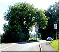
A bend in the A4042 SW of Penperlleni
Viewed from the corner of School Lane.
The sign partly hidden by vegetation shows that there is an emergency telephone ½ mile ahead.
Image: © Jaggery
Taken: 30 Jun 2011
0.03 miles
6
Wales & West Utilities gas installation, School Lane, Penperlleni
Located near the corner of Folly View Close on the right. An EX in a black-lined yellow triangle indicates a potentially explosive atmosphere - smoking prohibited. A notice shows a Wales & West Utilities Plant Protection phone number to ring before beginning any works on, or within 10 metres of, this site.
Image: © Jaggery
Taken: 12 Jun 2016
0.03 miles
7
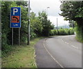
Usk Road parking area and emergency phone half-a-mile ahead, Penperlleni
The sign is alongside the A4042 Usk Road near the corner of School Lane.
Image: © Jaggery
Taken: 12 Jun 2016
0.03 miles
8
From 20 to 40 in Penperlleni
The 20mph speed limit on School Lane near Goytre Fawr Primary School increases to 40mph at the A4042 Usk Road junction.
Image: © Jaggery
Taken: 12 Jun 2016
0.04 miles
9
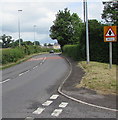
Warning sign - minor crossroads 180 yards ahead, Penperlleni
Alongside the A4042 Usk Road near the corner of School Lane.
Image: © Jaggery
Taken: 12 Jun 2016
0.04 miles
10
Goytre Fawr Primary School, Penperlleni
Located on School Lane in the village of Penperlleni, Monmouthshire.
Image: © Jaggery
Taken: 30 Jun 2011
0.04 miles


