1
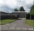
Entrance to Drybridge Park, Monmouth
Road from the B4233 Rockfield Road to flats in Drybridge Park.
Image: © Jaggery
Taken: 18 Aug 2020
0.01 miles
2
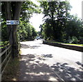
Free car park direction sign, Rockfield Road, Monmouth
The black arrow on the sign alongside the B4233 Rockfield Road points towards the entrance https://www.geograph.org.uk/photo/6573899 to Rockfield Road Car Park. The sign shows that the Welsh for Free in this context is Di-dâl (without payment).
Image: © Jaggery
Taken: 18 Aug 2020
0.02 miles
3
Sunday morning cyclists in Monmouth
Travelling north on the B4233 Rockfield Road in July 2020.
Image: © Jaggery
Taken: 12 Jul 2020
0.02 miles
4
Row of houses west of Rockfield Road, Monmouth
Located between the B4233 Rockfield Road and Monnow Vale Hospital out of shot ahead.
Image: © Jaggery
Taken: 12 Jul 2020
0.02 miles
5
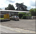
Yellow donations bin, Rockfield Road, Monmouth
Located near Monmouth Fire Station https://www.geograph.org.uk/photo/6573857 the yellow bin is for donations of shoes and clothing to the Firefighters Charity. Proceeds from the sale of these items help injured firefighters.
Image: © Jaggery
Taken: 18 Aug 2020
0.02 miles
6
Main entrance to Monnow Vale
Administered by Bridges, 'Monmouth's Independent Charity'.
Image: © Pauline E
Taken: 7 Apr 2009
0.02 miles
7
Entrance to Rockfield Road Car Park, Monmouth
Viewed in August 2020. A metal barrier enforces a 2.4 metres (7' 10") vehicle height limit. The notice on the right shows that this is a free car park (for cars and light vans only). No trading. No dwelling. Enforcement in operation.
Image: © Jaggery
Taken: 18 Aug 2020
0.03 miles
8
Monmouth Fire Station
Part of the South Wales Fire and Rescue Service, the fire station is set back from the B4233 Rockfield Road near Monmouth Ambulance Station. https://www.geograph.org.uk/photo/6573851
Image: © Jaggery
Taken: 18 Aug 2020
0.03 miles
9
Monmouth Fire Station
Monmouth Fire Station, Rockfield Road, Monmouth is one of the 50 fire stations making up South Wales Fire & Rescue Service
Image: © Kevin Hale
Taken: 3 Jun 2007
0.03 miles
10
Fire station and tower
Rockfield Road, Monmouth.
Image: © Pauline E
Taken: 7 Apr 2009
0.03 miles


