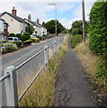
IMAGES TAKEN NEAR TO
The Rickfield, MONMOUTH, NP25 3HL

Introduction

This page details the photographs taken nearby to The Rickfield, NP25 3HL by members of the Geograph project.

The Geograph project started in 2005 with the aim of publishing, organising and preserving representative images for every square kilometre of Great Britain, Ireland and the Isle of Man.

There are currently over 7.5m images from over14,400 individuals and you can help contribute to the project by visiting https://www.geograph.org.uk

Image Map


Images are licensed for reuse under creativecommons.org/licenses/by-sa/2.0
Notes
  • Clicking on the map will re-center to the selected point.
  • The higher the marker number, the further away the image location is from the centre of the postcode.

Image Listing (38 Images Found)

Images are licensed for reuse under creativecommons.org/licenses/by-sa/2.0
  • ...
Image
Details
Distance
1
The Rickfield, Monmouth
Residential cul-de-sac on the south side of Priory Lane.
Image: © Jaggery Taken: 21 Aug 2016
0.02 miles
2
Hedge-lined Priory Lane, Monmouth
East from the A466 Hereford Road towards The Rickfield http://www.geograph.org.uk/photo/5156664 and Priory Farm.
Image: © Jaggery Taken: 21 Aug 2016
0.05 miles
3
Priory Lane towards Priory Farm, Monmouth
Past the corner of The Rickfield. http://www.geograph.org.uk/photo/5156664
Image: © Jaggery Taken: 21 Aug 2016
0.05 miles
4
Priory Lane
Priory Lane looking towards Priory Farm.
Image: © Martin Speck Taken: 17 Apr 2013
0.05 miles
5
Ordnance Survey Cut Mark
This OS cut mark can be found on No65 Hereford Road. It marks a point 67.013m above mean sea level.
Image: © Adrian Dust Taken: 30 Jan 2019
0.06 miles
6
Vine Court, Monmouth
Flats on the corner of Hereford Road and The Vineyard.
Image: © Jaggery Taken: 21 Aug 2016
0.08 miles
7
Duncan Mitchell house building site in the north of Monmouth
Viewed across the A466 Hereford Road in August 2016. A Duncan Mitchell Developments notice states Land acquired for development. 3 four/five bedroom executive homes coming soon.
Image: © Jaggery Taken: 21 Aug 2016
0.09 miles
8
Elevated pavement above Hereford Road, Monmouth
Above the east side of the A466 Hereford Road.
Image: © Jaggery Taken: 21 Aug 2016
0.09 miles
9
Vine Acre, Monmouth
Cul-de-sac viewed across the A466 Hereford Road.
Image: © Jaggery Taken: 21 Aug 2016
0.09 miles
10
Elevated pavement, Hereford Road, Monmouth
There is a long stretch of pavement raised above road level on the east side of Hereford Road (A466). The section seen here is on the west side of houses in The Rickfield. The right turn is into Vine Acre. http://www.geograph.org.uk/photo/5403894
Image: © Jaggery Taken: 22 Oct 2011
0.09 miles
  • ...