IMAGES TAKEN NEAR TO
Stanfield Street, EBBW VALE, NP23 7TG

Introduction

This page details the photographs taken nearby to Stanfield Street, NP23 7TG by members of the Geograph project.

The Geograph project started in 2005 with the aim of publishing, organising and preserving representative images for every square kilometre of Great Britain, Ireland and the Isle of Man.

There are currently over 7.5m images from over14,400 individuals and you can help contribute to the project by visiting https://www.geograph.org.uk

Image Map


Images are licensed for reuse under creativecommons.org/licenses/by-sa/2.0
Notes
  • Clicking on the map will re-center to the selected point.
  • The higher the marker number, the further away the image location is from the centre of the postcode.

Image Listing (30 Images Found)

Images are licensed for reuse under creativecommons.org/licenses/by-sa/2.0
  • ...
Image
Details
Distance
1
Cwm in the snow
Image: © andy dolman Taken: 8 Feb 2009
0.03 miles
2
Marine Street, Tallistown, Cwm
This pit village is laid out along the valley floor in an elongated grid.
Image: © Jonathan Billinger Taken: 28 Jan 2010
0.05 miles
3
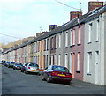
King Street, Tallistown, Cwm 2
Looking north-west towards this ex-pit village centre.
Image: © Jonathan Billinger Taken: 28 Jan 2010
0.07 miles
4
Graig Terrace, Cwm
Viewed from Marine Street, looking along the northeast end of Graig Terrace. In the distance is the A4046.
Image: © Jaggery Taken: 23 Jun 2010
0.08 miles
5
King Street, Tallistown, Cwm 3
Looking straight up the centre-line of this pit-village street.
Image: © Jonathan Billinger Taken: 28 Jan 2010
0.08 miles
6
Ordnance Survey Cut Mark
This OS cut mark can be found on No21 Stewart Street. It marks a point 196.663m above mean sea level.
Image: © Adrian Dust Taken: 4 Aug 2018
0.08 miles
7
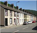
King Street, Cwm
Viewed from the corner of York Terrace. This is the NE section of a long line of terraced houses on both sides of the street.
Image: © Jaggery Taken: 23 Jun 2010
0.09 miles
8
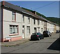
Marine Street, Cwm
Marine Street is one of the central streets of Cwm that follow a NW-SE course along the valley of the Ebbw river. Seen here are houses on the east side of the street, viewed from the corner of Graig Terrace.
Image: © Jaggery Taken: 23 Jun 2010
0.10 miles
9
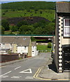
Tallistown view
Looking north-east, at right angles to the main road, this shows the proximity of the steep valley side to this pit village. The houses are the backs of King Street. Traffic on the elevated A4046 can be seen level with the roof apex.
Image: © Jonathan Billinger Taken: 28 Jan 2010
0.10 miles
10
Tallistown Congregational Church, Cwm
On the corner of Marine Street and York Terrace.
Image: © Jaggery Taken: 23 Jun 2010
0.11 miles
  • ...