1
Keystone and Iron Tie, Newtown Bridge
This photograph shows the earliest dated keystone of the many arches that make up the Newtown Bridge complex. This one is dated 1813 when the second and largest arch was erected to carry a horse drawn railway over the valley. Below is a cast iron tie supporting the keystones. The whole immense structure is a Grade II listed structure.
Image: © Colin Cheesman
Taken: 3 Apr 2008
0.03 miles
2
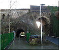
Bridge over Steel Works Road - Ebbw Vale
This impressive stone bridge links the town centre and Newtown. There are several archways; this view shows the arch constructed in 1861. To the left is an archway over the river constructed in 1790 and to the left is an archway built in 1813 for the tramway running to the steel works. The photographer is on the site of the old lower Ebbw Vale railway station. The old Road Arch is up to the right and the road after passing through the arch used to bend left over the railway bridge (no longer there) and then right and on down the valley. Around 1970 a new tunnel (arch) was constructed next to the road arch for pedestrians, and is probably still there.
Image: © Tony Bailey
Taken: 21 Nov 2007
0.03 miles
3
Newtown Bridge, Steelworks Road, Ebbw Vale
This is the view from the north looking from the adjacent pedestrian bridge towards Newtown Bridge and the former steelworks. The arch dates from 1813 and carried a former railway line across the valley. The bridge is a Grade II listed structure as it is one of the largest early horse drawn railway bridges in Britain. It is a truly massive and inspiring structure.
Image: © Colin Cheesman
Taken: 3 Apr 2008
0.03 miles
4
Western Bridge, The Crescent, Ebbw Vale
This is the western bridge of the Newtown Bridge complex and carries The Crescent under the former railway. Originally constructed of wood this was rebuilt in stone in 1859. This structure collapsed killing two men and was rebuilt in 1861. This is the road bridge we see today. Next door a prefabricated concrete pedestrian tunnel was put in 1964. The whole Newtown Bridge is a Grade II listed structure.
Image: © Colin Cheesman
Taken: 3 Apr 2008
0.04 miles
5
Light at the end of the tunnel, Ebbw Vale
Viewed from The Crescent. The pedestrian tunnel is on the east side of Grade II listed Newtown Bridge. http://www.geograph.org.uk/photo/617492
Image: © Jaggery
Taken: 27 May 2015
0.05 miles
6
Station Cottages, Ebbw Vale
Two semi-detached houses in Station Approach, viewed from a footbridge. http://www.geograph.org.uk/photo/2733450
The name of the cottages and street is a relic of a long-closed railway station. Ebbw Vale's only one currently (December 2011) is Ebbw Vale Parkway, http://www.geograph.org.uk/photo/2624631 about two miles to the south.
Image: © Jaggery
Taken: 17 Dec 2011
0.06 miles
7
The Dingle, Ebbw Vale
The Dingle is a group of six houses on the east side of Steel Works Road.
Image: © Jaggery
Taken: 17 Dec 2011
0.06 miles
8
Metal frame supports Grade II listed Newtown Bridge, Ebbw Vale
Viewed from the south side. http://www.geograph.org.uk/photo/2733443 to a view from the north side.
Image: © Jaggery
Taken: 17 Dec 2011
0.06 miles
9
Grade II listed Newtown Bridge, Ebbw Vale
Viewed from the north side, along Steel Works Road. A metal frame supports the Grade II listed bridge. http://www.geograph.org.uk/photo/617492 to a view taken before the frame was installed, and a brief history.
Image: © Jaggery
Taken: 17 Dec 2011
0.06 miles
10
Pedestrian tunnel, Newtown Bridge, Ebbw Vale
Part of the Grade II listed bridge http://www.geograph.org.uk/photo/2733443 is a tunnel conveying a footpath.
Image: © Jaggery
Taken: 17 Dec 2011
0.06 miles


