Keystone and Iron Tie, Newtown Bridge
Introduction
The photograph on this page of Keystone and Iron Tie, Newtown Bridge by Colin Cheesman as part of the Geograph project.
The Geograph project started in 2005 with the aim of publishing, organising and preserving representative images for every square kilometre of Great Britain, Ireland and the Isle of Man.

There are currently over 7.5m images from over 14,400 individuals and you can help contribute to the project by visiting https://www.geograph.org.uk
Keystone and Iron Tie, Newtown Bridge
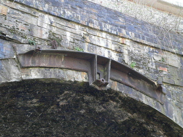
Image: © Colin Cheesman Taken: 3 Apr 2008
This photograph shows the earliest dated keystone of the many arches that make up the Newtown Bridge complex. This one is dated 1813 when the second and largest arch was erected to carry a horse drawn railway over the valley. Below is a cast iron tie supporting the keystones. The whole immense structure is a Grade II listed structure.
Images are licensed for reuse under creativecommons.org/licenses/by-sa/2.0
Image Location
Latitude
51.781126
Longitude
-3.20542